You are here: Home > Network List > TA - USArray Transportable Network (new EarthScope stations) Stations List
> Station T25A Trinidad, CO, USA > Earthquake Result Viewer
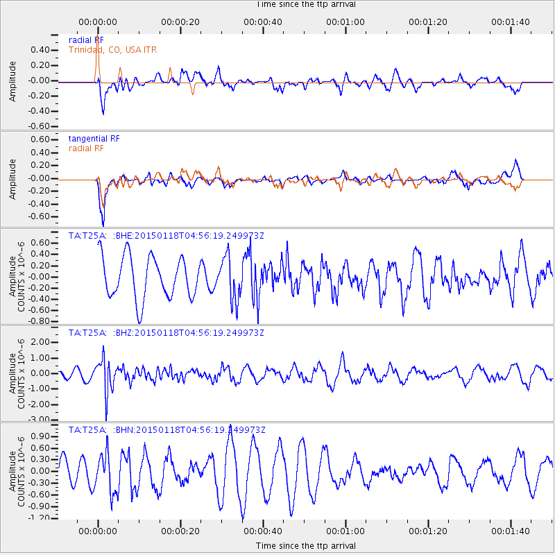
T25A Trinidad, CO, USA - Earthquake Result Viewer
*The percent match for this event was below the threshold and hence no stack was calculated.
| Earthquake location: |
Rat Islands, Aleutian Islands |
| Earthquake latitude/longitude: |
51.9/179.6 |
| Earthquake time(UTC): |
2015/01/18 (018) 04:47:38 GMT |
| Earthquake Depth: |
106 km |
| Earthquake Magnitude: |
5.8 MB, 5.9 MB |
| Earthquake Catalog/Contributor: |
NEIC PDE/NEIC COMCAT |
|
| Network: |
TA USArray Transportable Network (new EarthScope stations) |
| Station: |
T25A Trinidad, CO, USA |
| Lat/Lon: |
37.14 N/104.41 W |
| Elevation: |
2017 m |
|
| Distance: |
53.7 deg |
| Az: |
74.098 deg |
| Baz: |
311.789 deg |
| Ray Param: |
$rayparam |
*The percent match for this event was below the threshold and hence was not used in the summary stack. |
|
| Radial Match: |
57.110382 % |
| Radial Bump: |
400 |
| Transverse Match: |
84.70442 % |
| Transverse Bump: |
400 |
| SOD ConfigId: |
837871 |
| Insert Time: |
2015-02-01 05:22:35.194 +0000 |
| GWidth: |
2.5 |
| Max Bumps: |
400 |
| Tol: |
0.001 |
|
Signal To Noise
| Channel | StoN | STA | LTA |
| TA:T25A: :BHZ:20150118T04:56:19.249973Z | 3.1777127 | 1.0393792E-6 | 3.2708408E-7 |
| TA:T25A: :BHN:20150118T04:56:19.249973Z | 1.4727015 | 5.101108E-7 | 3.463776E-7 |
| TA:T25A: :BHE:20150118T04:56:19.249973Z | 1.04028 | 3.846394E-7 | 3.6974603E-7 |
| Arrivals |
| Ps | |
| PpPs | |
| PsPs/PpSs | |


