XMAS Kiritimati Island, Republic of Kiribati - Earthquake Result Viewer
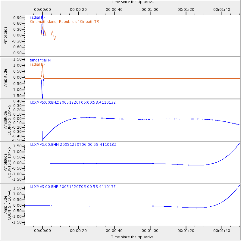
Earthquake location: W. Caroline Islands, Micronesia
Earthquake latitude/longitude: 12.2/141.0
Earthquake time(UTC): 2005/12/20 (354) 05:51:12 GMT
Earthquake Depth: 23 km
Earthquake Magnitude: 5.8 MB, 5.7 MS, 6.1 MW, 6.1 MW
Earthquake Catalog/Contributor: WHDF/NEIC
Network: IU Global Seismograph Network (GSN - IRIS/USGS)
Station: XMAS Kiritimati Island, Republic of Kiribati
Lat/Lon: 2.04 N/157.45 W
Elevation: 2.0 m
Distance: 61.8 deg
Az: 94.266 deg
Baz: 282.71 deg
Ray Param: 0.060623124
Estimated Moho Depth: 10.0 km
Estimated Crust Vp/Vs: 1.60
Assumed Crust Vp: 4.802 km/s
Estimated Crust Vs: 3.001 km/s
Estimated Crust Poisson's Ratio: 0.18
Radial Match: 100.0 %
Radial Bump: 2
Transverse Match: 100.0 %
Transverse Bump: 2
SOD ConfigId: 2669
Insert Time: 2010-03-02 15:46:32.773 +0000
GWidth: 2.5
Max Bumps: 400
Tol: 0.001

Signal To Noise

ChannelStoNSTALTA
IU:XMAS:00:BHN:20051220T06:00:58.411013Z0.91273181.3922512E-71.5253673E-7
IU:XMAS:00:BHE:20051220T06:00:58.411013Z0.913176661.393874E-71.5264011E-7
IU:XMAS:00:BHZ:20051220T06:00:58.411013Z0.91262521.3907432E-71.523893E-7
Arrivals
Ps1.3 SECOND
PpPs5.3 SECOND
PsPs/PpSs6.6 SECOND