You are here: Home > Network List > IU - Global Seismograph Network (GSN - IRIS/USGS) Stations List
> Station XMAS Kiritimati Island, Republic of Kiribati > Earthquake Result Viewer
XMAS Kiritimati Island, Republic of Kiribati - Earthquake Result Viewer

| Earthquake location: |
Talaud Islands, Indonesia |
| Earthquake latitude/longitude: |
4.6/125.4 |
| Earthquake time(UTC): |
2006/04/16 (106) 17:46:15 GMT |
| Earthquake Depth: |
185 km |
| Earthquake Magnitude: |
5.5 MB, 5.7 MW, 5.7 MW |
| Earthquake Catalog/Contributor: |
WHDF/NEIC |
|
| Network: |
IU Global Seismograph Network (GSN - IRIS/USGS) |
| Station: |
XMAS Kiritimati Island, Republic of Kiribati |
| Lat/Lon: |
2.04 N/157.45 W |
| Elevation: |
2.0 m |
|
| Distance: |
77.1 deg |
| Az: |
88.961 deg |
| Baz: |
274.219 deg |
| Ray Param: |
0.050104205 |
| Estimated Moho Depth: |
10.0 km |
| Estimated Crust Vp/Vs: |
1.60 |
| Assumed Crust Vp: |
4.802 km/s |
| Estimated Crust Vs: |
3.001 km/s |
| Estimated Crust Poisson's Ratio: |
0.18 |
|
| Radial Match: |
100.0 % |
| Radial Bump: |
2 |
| Transverse Match: |
100.0 % |
| Transverse Bump: |
2 |
| SOD ConfigId: |
5423 |
| Insert Time: |
2010-03-02 15:47:34.437 +0000 |
| GWidth: |
2.5 |
| Max Bumps: |
400 |
| Tol: |
0.001 |
|
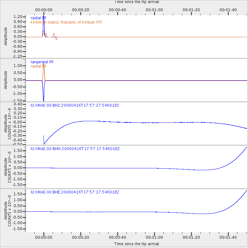
Signal To Noise
| Channel | StoN | STA | LTA |
| IU:XMAS:00:BHN:20060416T17:57:17.546018Z | 0.91146773 | 1.3950078E-7 | 1.5305072E-7 |
| IU:XMAS:00:BHE:20060416T17:57:17.546018Z | 0.91199493 | 1.3949825E-7 | 1.5295946E-7 |
| IU:XMAS:00:BHZ:20060416T17:57:17.546018Z | 0.9116833 | 1.3900136E-7 | 1.5246671E-7 |
| Arrivals |
| Ps | 1.3 SECOND |
| PpPs | 5.3 SECOND |
| PsPs/PpSs | 6.6 SECOND |


