XMAS Kiritimati Island, Republic of Kiribati - Earthquake Result Viewer
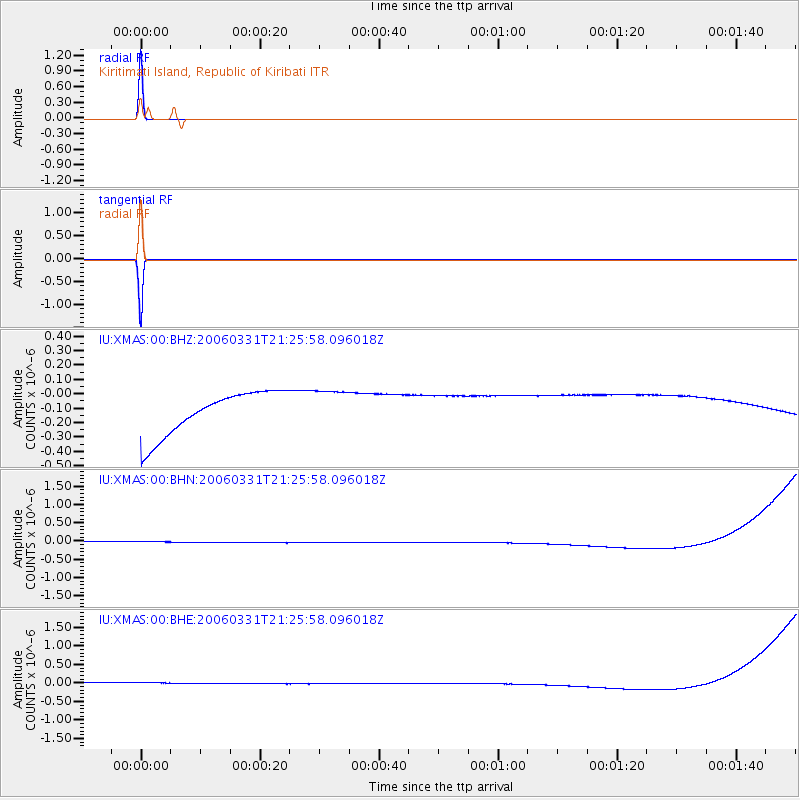
Earthquake location: Talaud Islands, Indonesia
Earthquake latitude/longitude: 3.8/126.4
Earthquake time(UTC): 2006/03/31 (090) 21:14:47 GMT
Earthquake Depth: 55 km
Earthquake Magnitude: 5.9 MB, 5.8 MS, 6.2 MW, 6.1 MW
Earthquake Catalog/Contributor: WHDF/NEIC
Network: IU Global Seismograph Network (GSN - IRIS/USGS)
Station: XMAS Kiritimati Island, Republic of Kiribati
Lat/Lon: 2.04 N/157.45 W
Elevation: 2.0 m
Distance: 76.1 deg
Az: 88.836 deg
Baz: 273.374 deg
Ray Param: 0.051124293
Estimated Moho Depth: 10.0 km
Estimated Crust Vp/Vs: 1.60
Assumed Crust Vp: 4.802 km/s
Estimated Crust Vs: 3.001 km/s
Estimated Crust Poisson's Ratio: 0.18
Radial Match: 99.99999 %
Radial Bump: 2
Transverse Match: 100.0 %
Transverse Bump: 2
SOD ConfigId: 5423
Insert Time: 2010-03-02 15:47:42.200 +0000
GWidth: 2.5
Max Bumps: 400
Tol: 0.001

Signal To Noise

ChannelStoNSTALTA
IU:XMAS:00:BHN:20060331T21:25:58.096018Z0.91207511.3966596E-71.5312989E-7
IU:XMAS:00:BHE:20060331T21:25:58.096018Z0.911666631.3960071E-71.5312693E-7
IU:XMAS:00:BHZ:20060331T21:25:58.096018Z0.91147661.390898E-71.5259832E-7
Arrivals
Ps1.3 SECOND
PpPs5.3 SECOND
PsPs/PpSs6.6 SECOND