XMAS Kiritimati Island, Republic of Kiribati - Earthquake Result Viewer
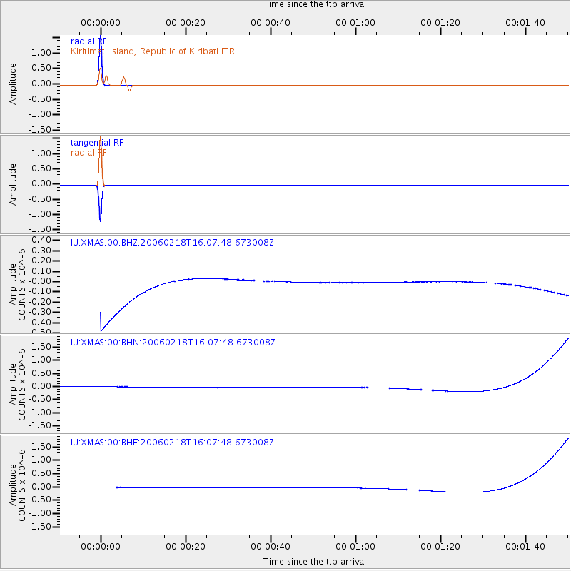
Earthquake location: New Britain Region, P.N.G.
Earthquake latitude/longitude: -5.2/152.1
Earthquake time(UTC): 2006/02/18 (049) 15:59:22 GMT
Earthquake Depth: 44 km
Earthquake Magnitude: 5.9 MB, 6.2 MS, 6.2 MW, 6.2 MW
Earthquake Catalog/Contributor: WHDF/NEIC
Network: IU Global Seismograph Network (GSN - IRIS/USGS)
Station: XMAS Kiritimati Island, Republic of Kiribati
Lat/Lon: 2.04 N/157.45 W
Elevation: 2.0 m
Distance: 51.0 deg
Az: 83.164 deg
Baz: 261.686 deg
Ray Param: 0.06761466
Estimated Moho Depth: 10.0 km
Estimated Crust Vp/Vs: 1.60
Assumed Crust Vp: 4.802 km/s
Estimated Crust Vs: 3.001 km/s
Estimated Crust Poisson's Ratio: 0.18
Radial Match: 100.0 %
Radial Bump: 2
Transverse Match: 100.0 %
Transverse Bump: 2
SOD ConfigId: 5423
Insert Time: 2010-03-02 15:47:45.239 +0000
GWidth: 2.5
Max Bumps: 400
Tol: 0.001

Signal To Noise

ChannelStoNSTALTA
IU:XMAS:00:BHN:20060218T16:07:48.673008Z0.91033491.392955E-71.5301566E-7
IU:XMAS:00:BHE:20060218T16:07:48.673008Z0.911201541.3939136E-71.5297535E-7
IU:XMAS:00:BHZ:20060218T16:07:48.673008Z0.911286531.3885406E-71.5237146E-7
Arrivals
Ps1.3 SECOND
PpPs5.2 SECOND
PsPs/PpSs6.5 SECOND