You are here: Home > Network List > IU - Global Seismograph Network (GSN - IRIS/USGS) Stations List
> Station XMAS Kiritimati Island, Republic of Kiribati > Earthquake Result Viewer
XMAS Kiritimati Island, Republic of Kiribati - Earthquake Result Viewer
| Earthquake location: |
Vanuatu Islands |
| Earthquake latitude/longitude: |
-14.8/167.4 |
| Earthquake time(UTC): |
2006/03/07 (066) 06:28:55 GMT |
| Earthquake Depth: |
136 km |
| Earthquake Magnitude: |
5.7 MB, 6.2 MW, 6.1 MW |
| Earthquake Catalog/Contributor: |
WHDF/NEIC |
|
| Network: |
IU Global Seismograph Network (GSN - IRIS/USGS) |
| Station: |
XMAS Kiritimati Island, Republic of Kiribati |
| Lat/Lon: |
2.04 N/157.45 W |
| Elevation: |
2.0 m |
|
| Distance: |
38.6 deg |
| Az: |
67.233 deg |
| Baz: |
243.18 deg |
| Ray Param: |
0.07495926 |
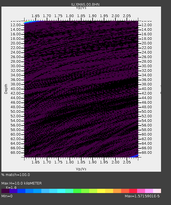
| Estimated Moho Depth: |
10.0 km |
| Estimated Crust Vp/Vs: |
1.60 |
| Assumed Crust Vp: |
4.802 km/s |
| Estimated Crust Vs: |
3.001 km/s |
| Estimated Crust Poisson's Ratio: |
0.18 |
|
| Radial Match: |
100.0 % |
| Radial Bump: |
2 |
| Transverse Match: |
100.0 % |
| Transverse Bump: |
2 |
| SOD ConfigId: |
2669 |
| Insert Time: |
2010-03-02 15:48:28.270 +0000 |
| GWidth: |
2.5 |
| Max Bumps: |
400 |
| Tol: |
0.001 |
|

Signal To Noise
| Channel | StoN | STA | LTA |
| IU:XMAS:00:BHN:20060307T06:35:34.871991Z | 0.91210705 | 1.3971582E-7 | 1.5317919E-7 |
| IU:XMAS:00:BHE:20060307T06:35:34.871991Z | 0.9115819 | 1.3953768E-7 | 1.5307202E-7 |
| IU:XMAS:00:BHZ:20060307T06:35:34.871991Z | 0.9118463 | 1.3912546E-7 | 1.5257557E-7 |
| Arrivals |
| Ps | 1.3 SECOND |
| PpPs | 5.2 SECOND |
| PsPs/PpSs | 6.5 SECOND |


