XMAS Kiritimati Island, Republic of Kiribati - Earthquake Result Viewer
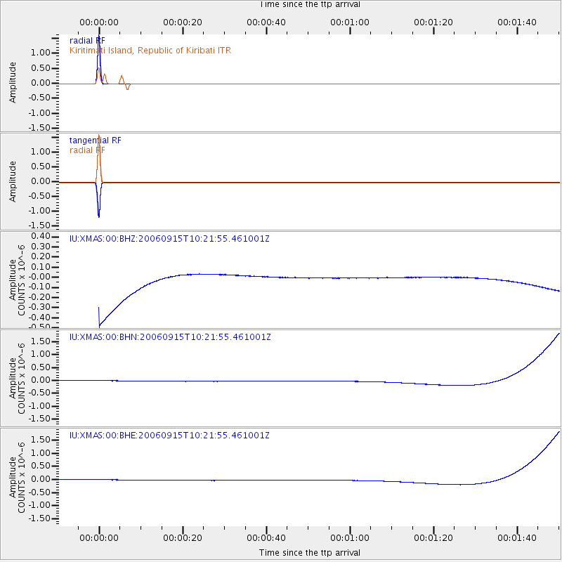
Earthquake location: New Britain Region, P.N.G.
Earthquake latitude/longitude: -6.0/150.5
Earthquake time(UTC): 2006/09/15 (258) 10:13:14 GMT
Earthquake Depth: 28 km
Earthquake Magnitude: 5.2 MB, 5.9 MS, 5.8 MW, 5.7 MW
Earthquake Catalog/Contributor: WHDF/NEIC
Network: IU Global Seismograph Network (GSN - IRIS/USGS)
Station: XMAS Kiritimati Island, Republic of Kiribati
Lat/Lon: 2.04 N/157.45 W
Elevation: 2.0 m
Distance: 52.6 deg
Az: 82.828 deg
Baz: 260.895 deg
Ray Param: 0.06659709
Estimated Moho Depth: 10.0 km
Estimated Crust Vp/Vs: 1.60
Assumed Crust Vp: 4.802 km/s
Estimated Crust Vs: 3.001 km/s
Estimated Crust Poisson's Ratio: 0.18
Radial Match: 100.0 %
Radial Bump: 2
Transverse Match: 100.0 %
Transverse Bump: 2
SOD ConfigId: 2564
Insert Time: 2010-03-02 15:48:47.226 +0000
GWidth: 2.5
Max Bumps: 400
Tol: 0.001

Signal To Noise

ChannelStoNSTALTA
IU:XMAS:00:BHN:20060915T10:21:55.461001Z0.910520261.3950441E-71.5321396E-7
IU:XMAS:00:BHE:20060915T10:21:55.461001Z0.909744861.393241E-71.5314636E-7
IU:XMAS:00:BHZ:20060915T10:21:55.461001Z0.91047571.3889326E-71.5255021E-7
Arrivals
Ps1.3 SECOND
PpPs5.2 SECOND
PsPs/PpSs6.5 SECOND