XMAS Kiritimati Island, Republic of Kiribati - Earthquake Result Viewer
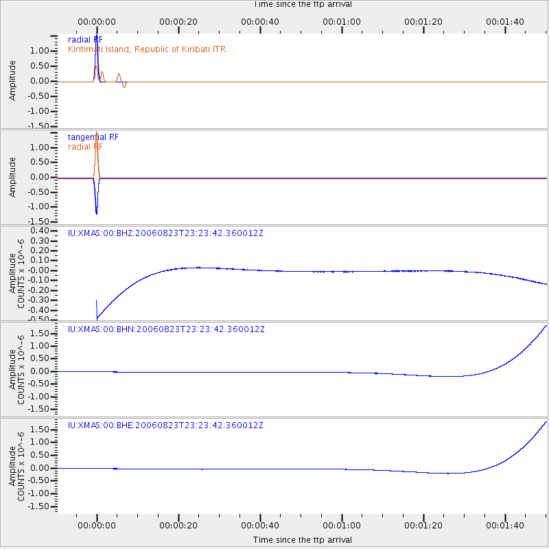
Earthquake location: New Britain Region, P.N.G.
Earthquake latitude/longitude: -4.2/152.8
Earthquake time(UTC): 2006/08/23 (235) 23:15:21 GMT
Earthquake Depth: 41 km
Earthquake Magnitude: 5.7 MB, 5.0 MS, 5.6 MW, 5.6 MW
Earthquake Catalog/Contributor: WHDF/NEIC
Network: IU Global Seismograph Network (GSN - IRIS/USGS)
Station: XMAS Kiritimati Island, Republic of Kiribati
Lat/Lon: 2.04 N/157.45 W
Elevation: 2.0 m
Distance: 50.1 deg
Az: 83.801 deg
Baz: 262.786 deg
Ray Param: 0.068192475
Estimated Moho Depth: 10.0 km
Estimated Crust Vp/Vs: 1.60
Assumed Crust Vp: 4.802 km/s
Estimated Crust Vs: 3.001 km/s
Estimated Crust Poisson's Ratio: 0.18
Radial Match: 100.0 %
Radial Bump: 2
Transverse Match: 100.0 %
Transverse Bump: 2
SOD ConfigId: 2564
Insert Time: 2010-03-02 15:49:03.891 +0000
GWidth: 2.5
Max Bumps: 400
Tol: 0.001

Signal To Noise

ChannelStoNSTALTA
IU:XMAS:00:BHN:20060823T23:23:42.360012Z0.91497351.3987878E-71.528774E-7
IU:XMAS:00:BHE:20060823T23:23:42.360012Z0.91440531.3976825E-71.5285153E-7
IU:XMAS:00:BHZ:20060823T23:23:42.360012Z0.91480071.392992E-71.5227273E-7
Arrivals
Ps1.3 SECOND
PpPs5.2 SECOND
PsPs/PpSs6.5 SECOND