You are here: Home > Network List > UU - University of Utah Regional Network Stations List
> Station KNB Kanab, UT, USA > Earthquake Result Viewer
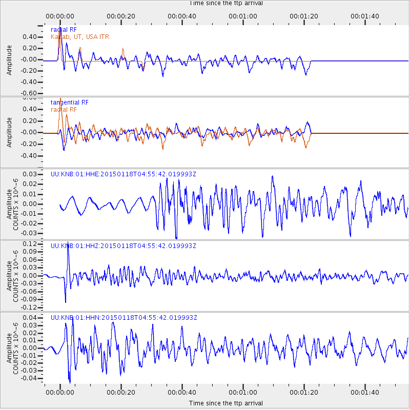
KNB Kanab, UT, USA - Earthquake Result Viewer
*The percent match for this event was below the threshold and hence no stack was calculated.
| Earthquake location: |
Rat Islands, Aleutian Islands |
| Earthquake latitude/longitude: |
51.9/179.6 |
| Earthquake time(UTC): |
2015/01/18 (018) 04:47:38 GMT |
| Earthquake Depth: |
106 km |
| Earthquake Magnitude: |
5.8 MB, 5.9 MB |
| Earthquake Catalog/Contributor: |
NEIC PDE/NEIC COMCAT |
|
| Network: |
UU University of Utah Regional Network |
| Station: |
KNB Kanab, UT, USA |
| Lat/Lon: |
37.02 N/112.82 W |
| Elevation: |
1715 m |
|
| Distance: |
48.7 deg |
| Az: |
79.881 deg |
| Baz: |
310.359 deg |
| Ray Param: |
$rayparam |
*The percent match for this event was below the threshold and hence was not used in the summary stack. |
|
| Radial Match: |
63.18116 % |
| Radial Bump: |
400 |
| Transverse Match: |
47.098923 % |
| Transverse Bump: |
400 |
| SOD ConfigId: |
837871 |
| Insert Time: |
2015-02-01 05:26:27.270 +0000 |
| GWidth: |
2.5 |
| Max Bumps: |
400 |
| Tol: |
0.001 |
|
Signal To Noise
| Channel | StoN | STA | LTA |
| UU:KNB:01:HHZ:20150118T04:55:42.019993Z | 4.750658 | 4.179022E-8 | 8.7967225E-9 |
| UU:KNB:01:HHN:20150118T04:55:42.019993Z | 2.745649 | 2.1014609E-8 | 7.653785E-9 |
| UU:KNB:01:HHE:20150118T04:55:42.019993Z | 2.7025027 | 1.23202835E-8 | 4.558842E-9 |
| Arrivals |
| Ps | |
| PpPs | |
| PsPs/PpSs | |


