XMAS Kiritimati Island, Republic of Kiribati - Earthquake Result Viewer
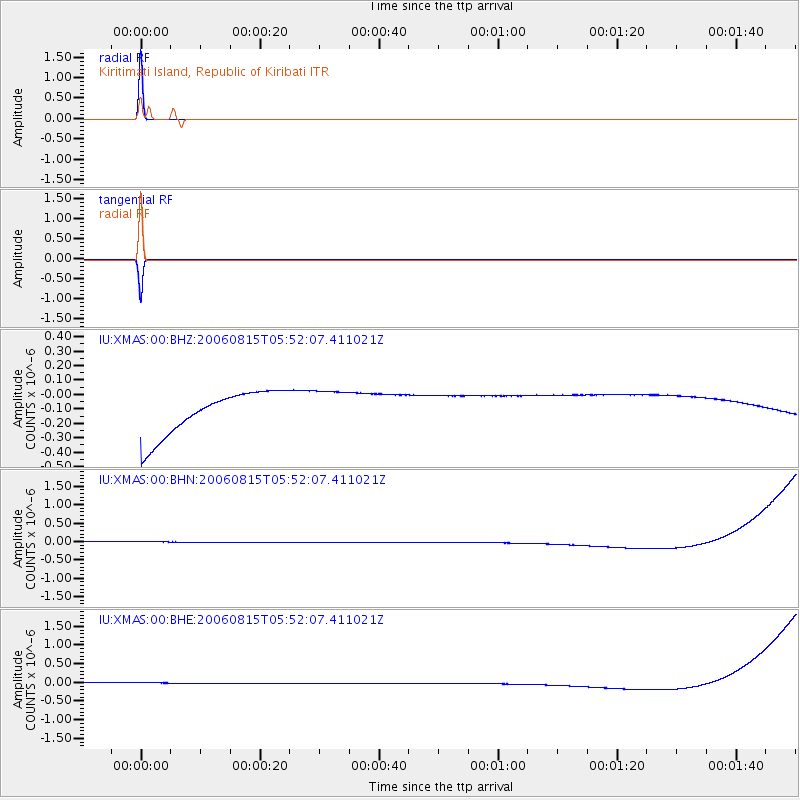
Earthquake location: Eastern New Guinea Reg., P.N.G.
Earthquake latitude/longitude: -9.3/150.5
Earthquake time(UTC): 2006/08/15 (227) 05:43:20 GMT
Earthquake Depth: 10 km
Earthquake Magnitude: 5.9 MB, 5.3 MS, 5.7 MW, 5.7 MW
Earthquake Catalog/Contributor: WHDF/NEIC
Network: IU Global Seismograph Network (GSN - IRIS/USGS)
Station: XMAS Kiritimati Island, Republic of Kiribati
Lat/Lon: 2.04 N/157.45 W
Elevation: 2.0 m
Distance: 53.1 deg
Az: 80.401 deg
Baz: 256.879 deg
Ray Param: 0.06633842
Estimated Moho Depth: 10.0 km
Estimated Crust Vp/Vs: 1.60
Assumed Crust Vp: 4.802 km/s
Estimated Crust Vs: 3.001 km/s
Estimated Crust Poisson's Ratio: 0.18
Radial Match: 100.0 %
Radial Bump: 2
Transverse Match: 100.0 %
Transverse Bump: 2
SOD ConfigId: 2564
Insert Time: 2010-03-02 15:49:07.368 +0000
GWidth: 2.5
Max Bumps: 400
Tol: 0.001

Signal To Noise

ChannelStoNSTALTA
IU:XMAS:00:BHN:20060815T05:52:07.411021Z0.910455761.3942987E-71.5314293E-7
IU:XMAS:00:BHE:20060815T05:52:07.411021Z0.91049411.3937118E-71.5307202E-7
IU:XMAS:00:BHZ:20060815T05:52:07.411021Z0.910178241.3882199E-71.5252175E-7
Arrivals
Ps1.3 SECOND
PpPs5.2 SECOND
PsPs/PpSs6.5 SECOND