You are here: Home > Network List > IU - Global Seismograph Network (GSN - IRIS/USGS) Stations List
> Station XMAS Kiritimati Island, Republic of Kiribati > Earthquake Result Viewer
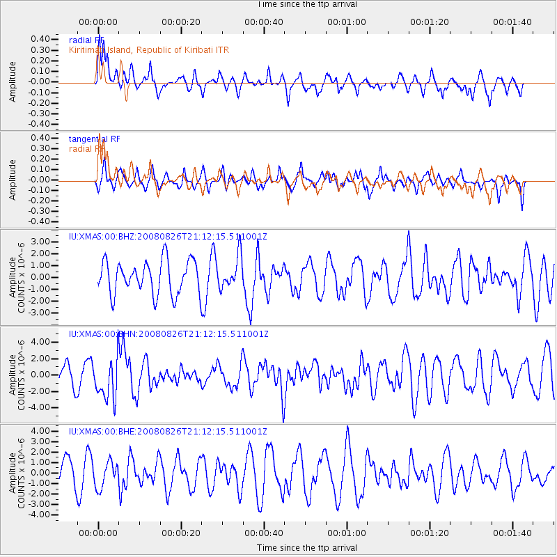
XMAS Kiritimati Island, Republic of Kiribati - Earthquake Result Viewer
*The percent match for this event was below the threshold and hence no stack was calculated.
| Earthquake location: |
Peru-Brazil Border Region |
| Earthquake latitude/longitude: |
-7.6/-74.4 |
| Earthquake time(UTC): |
2008/08/26 (239) 21:00:36 GMT |
| Earthquake Depth: |
154 km |
| Earthquake Magnitude: |
6.0 MB, 6.4 MW, 6.4 MW |
| Earthquake Catalog/Contributor: |
WHDF/NEIC |
|
| Network: |
IU Global Seismograph Network (GSN - IRIS/USGS) |
| Station: |
XMAS Kiritimati Island, Republic of Kiribati |
| Lat/Lon: |
2.04 N/157.45 W |
| Elevation: |
2.0 m |
|
| Distance: |
83.4 deg |
| Az: |
272.947 deg |
| Baz: |
97.883 deg |
| Ray Param: |
$rayparam |
*The percent match for this event was below the threshold and hence was not used in the summary stack. |
|
| Radial Match: |
67.03656 % |
| Radial Bump: |
400 |
| Transverse Match: |
51.199413 % |
| Transverse Bump: |
368 |
| SOD ConfigId: |
2504 |
| Insert Time: |
2010-03-02 15:50:06.276 +0000 |
| GWidth: |
2.5 |
| Max Bumps: |
400 |
| Tol: |
0.001 |
|
Signal To Noise
| Channel | StoN | STA | LTA |
| IU:XMAS:00:BHN:20080826T21:12:15.511001Z | 2.5064769 | 2.545071E-6 | 1.0153977E-6 |
| IU:XMAS:00:BHE:20080826T21:12:15.511001Z | 1.1340647 | 1.2318658E-6 | 1.0862394E-6 |
| IU:XMAS:00:BHZ:20080826T21:12:15.511001Z | 0.97793686 | 1.3681268E-6 | 1.3989929E-6 |
| Arrivals |
| Ps | |
| PpPs | |
| PsPs/PpSs | |


