You are here: Home > Network List > IU - Global Seismograph Network (GSN - IRIS/USGS) Stations List
> Station XMAS Kiritimati Island, Republic of Kiribati > Earthquake Result Viewer
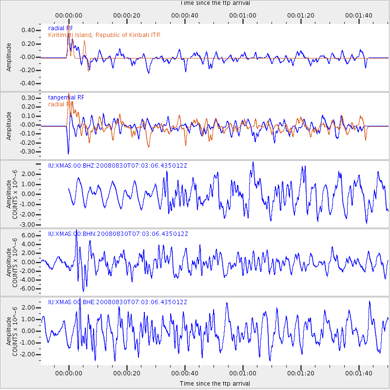
XMAS Kiritimati Island, Republic of Kiribati - Earthquake Result Viewer
*The percent match for this event was below the threshold and hence no stack was calculated.
| Earthquake location: |
Eastern New Guinea Reg., P.N.G. |
| Earthquake latitude/longitude: |
-6.1/147.3 |
| Earthquake time(UTC): |
2008/08/30 (243) 06:54:07 GMT |
| Earthquake Depth: |
75 km |
| Earthquake Magnitude: |
6.1 MB, 6.4 MW, 6.3 MW |
| Earthquake Catalog/Contributor: |
WHDF/NEIC |
|
| Network: |
IU Global Seismograph Network (GSN - IRIS/USGS) |
| Station: |
XMAS Kiritimati Island, Republic of Kiribati |
| Lat/Lon: |
2.04 N/157.45 W |
| Elevation: |
2.0 m |
|
| Distance: |
55.8 deg |
| Az: |
83.352 deg |
| Baz: |
261.213 deg |
| Ray Param: |
$rayparam |
*The percent match for this event was below the threshold and hence was not used in the summary stack. |
|
| Radial Match: |
70.65986 % |
| Radial Bump: |
400 |
| Transverse Match: |
62.818054 % |
| Transverse Bump: |
400 |
| SOD ConfigId: |
2504 |
| Insert Time: |
2010-03-02 15:50:08.423 +0000 |
| GWidth: |
2.5 |
| Max Bumps: |
400 |
| Tol: |
0.001 |
|
Signal To Noise
| Channel | StoN | STA | LTA |
| IU:XMAS:00:BHN:20080830T07:03:06.435012Z | 4.6601853 | 2.6242008E-6 | 5.631108E-7 |
| IU:XMAS:00:BHE:20080830T07:03:06.435012Z | 1.3658383 | 1.1491824E-6 | 8.4137514E-7 |
| IU:XMAS:00:BHZ:20080830T07:03:06.435012Z | 1.3779422 | 1.0631072E-6 | 7.7151805E-7 |
| Arrivals |
| Ps | |
| PpPs | |
| PsPs/PpSs | |


