You are here: Home > Network List > IU - Global Seismograph Network (GSN - IRIS/USGS) Stations List
> Station XMAS Kiritimati Island, Republic of Kiribati > Earthquake Result Viewer
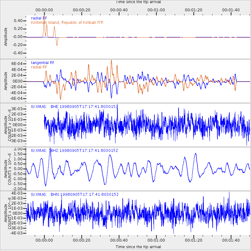
XMAS Kiritimati Island, Republic of Kiribati - Earthquake Result Viewer
*The percent match for this event was below the threshold and hence no stack was calculated.
| Earthquake location: |
New Britain Region, P.N.G. |
| Earthquake latitude/longitude: |
-4.1/152.0 |
| Earthquake time(UTC): |
1998/09/05 (248) 17:09:31 GMT |
| Earthquake Depth: |
192 km |
| Earthquake Magnitude: |
5.5 MB |
| Earthquake Catalog/Contributor: |
WHDF/NEIC |
|
| Network: |
IU Global Seismograph Network (GSN - IRIS/USGS) |
| Station: |
XMAS Kiritimati Island, Republic of Kiribati |
| Lat/Lon: |
2.04 N/157.45 W |
| Elevation: |
2.0 m |
|
| Distance: |
50.8 deg |
| Az: |
84.082 deg |
| Baz: |
263.141 deg |
| Ray Param: |
$rayparam |
*The percent match for this event was below the threshold and hence was not used in the summary stack. |
|
| Radial Match: |
42.610577 % |
| Radial Bump: |
400 |
| Transverse Match: |
44.700207 % |
| Transverse Bump: |
400 |
| SOD ConfigId: |
4480 |
| Insert Time: |
2010-03-02 15:50:27.599 +0000 |
| GWidth: |
2.5 |
| Max Bumps: |
400 |
| Tol: |
0.001 |
|
Signal To Noise
| Channel | StoN | STA | LTA |
| IU:XMAS: :BHZ:19980905T17:17:41.803015Z | 3.4776144 | 1.0941286E-6 | 3.1462048E-7 |
| IU:XMAS: :BHN:19980905T17:17:41.803015Z | 1.0909995 | 1.260763E-9 | 1.1556037E-9 |
| IU:XMAS: :BHE:19980905T17:17:41.803015Z | 1.1893716 | 1.3330244E-9 | 1.1207805E-9 |
| Arrivals |
| Ps | |
| PpPs | |
| PsPs/PpSs | |


