You are here: Home > Network List > TA - USArray Transportable Network (new EarthScope stations) Stations List
> Station G59A Clarenceville, QC, USA > Earthquake Result Viewer
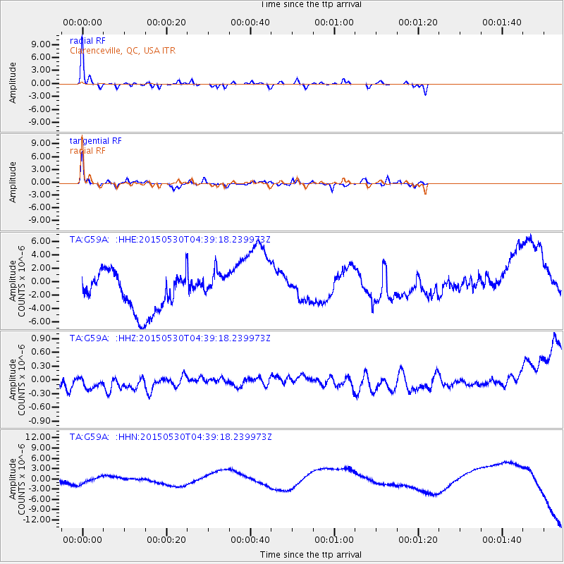
G59A Clarenceville, QC, USA - Earthquake Result Viewer
*The percent match for this event was below the threshold and hence no stack was calculated.
| Earthquake location: |
Kuril Islands |
| Earthquake latitude/longitude: |
46.7/150.3 |
| Earthquake time(UTC): |
2015/05/30 (150) 04:27:57 GMT |
| Earthquake Depth: |
200 km |
| Earthquake Magnitude: |
4.1 mb, 3.8 mb |
| Earthquake Catalog/Contributor: |
ISC/ISC |
|
| Network: |
TA USArray Transportable Network (new EarthScope stations) |
| Station: |
G59A Clarenceville, QC, USA |
| Lat/Lon: |
45.08 N/73.18 W |
| Elevation: |
36 m |
|
| Distance: |
80.9 deg |
| Az: |
29.59 deg |
| Baz: |
331.33 deg |
| Ray Param: |
$rayparam |
*The percent match for this event was below the threshold and hence was not used in the summary stack. |
|
| Radial Match: |
68.854546 % |
| Radial Bump: |
202 |
| Transverse Match: |
74.295166 % |
| Transverse Bump: |
280 |
| SOD ConfigId: |
7422571 |
| Insert Time: |
2019-04-19 02:55:47.787 +0000 |
| GWidth: |
2.5 |
| Max Bumps: |
400 |
| Tol: |
0.001 |
|
Signal To Noise
| Channel | StoN | STA | LTA |
| TA:G59A: :HHZ:20150530T04:39:18.239973Z | 1.0712622 | 6.287823E-7 | 5.8695457E-7 |
| TA:G59A: :HHN:20150530T04:39:18.239973Z | 0.6521243 | 3.5074802E-6 | 5.3785457E-6 |
| TA:G59A: :HHE:20150530T04:39:18.239973Z | 0.95337033 | 2.6644789E-6 | 2.7947995E-6 |
| Arrivals |
| Ps | |
| PpPs | |
| PsPs/PpSs | |


