You are here: Home > Network List > TA - USArray Transportable Network (new EarthScope stations) Stations List
> Station K61A Williamstown, MA, USA > Earthquake Result Viewer
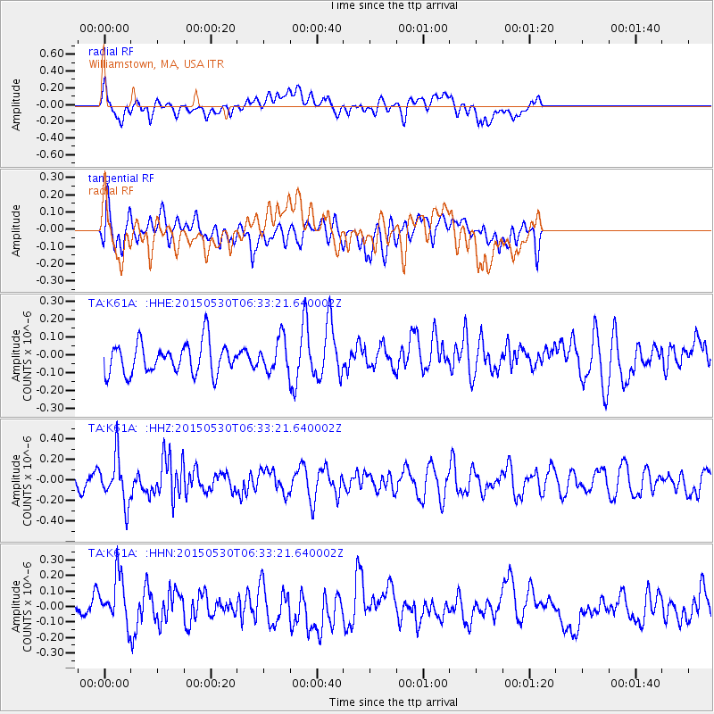
K61A Williamstown, MA, USA - Earthquake Result Viewer
*The percent match for this event was below the threshold and hence no stack was calculated.
| Earthquake location: |
Near Coast Of Ecuador |
| Earthquake latitude/longitude: |
1.2/-79.6 |
| Earthquake time(UTC): |
2015/05/30 (150) 06:26:06 GMT |
| Earthquake Depth: |
26 km |
| Earthquake Magnitude: |
5.4 MW, 5.3 mb, 4.8 MS |
| Earthquake Catalog/Contributor: |
ISC/ISC |
|
| Network: |
TA USArray Transportable Network (new EarthScope stations) |
| Station: |
K61A Williamstown, MA, USA |
| Lat/Lon: |
42.67 N/73.27 W |
| Elevation: |
391 m |
|
| Distance: |
41.7 deg |
| Az: |
6.997 deg |
| Baz: |
189.505 deg |
| Ray Param: |
$rayparam |
*The percent match for this event was below the threshold and hence was not used in the summary stack. |
|
| Radial Match: |
55.58523 % |
| Radial Bump: |
400 |
| Transverse Match: |
52.791935 % |
| Transverse Bump: |
400 |
| SOD ConfigId: |
7422571 |
| Insert Time: |
2019-04-19 03:04:54.481 +0000 |
| GWidth: |
2.5 |
| Max Bumps: |
400 |
| Tol: |
0.001 |
|
Signal To Noise
| Channel | StoN | STA | LTA |
| TA:K61A: :HHZ:20150530T06:33:21.640002Z | 3.0455534 | 2.2362035E-7 | 7.342519E-8 |
| TA:K61A: :HHN:20150530T06:33:21.640002Z | 3.1656396 | 1.6738049E-7 | 5.2874142E-8 |
| TA:K61A: :HHE:20150530T06:33:21.640002Z | 1.065621 | 9.151872E-8 | 8.5882995E-8 |
| Arrivals |
| Ps | |
| PpPs | |
| PsPs/PpSs | |


