You are here: Home > Network List > TA - USArray Transportable Network (new EarthScope stations) Stations List
> Station O48A Farmland, IN, USA > Earthquake Result Viewer
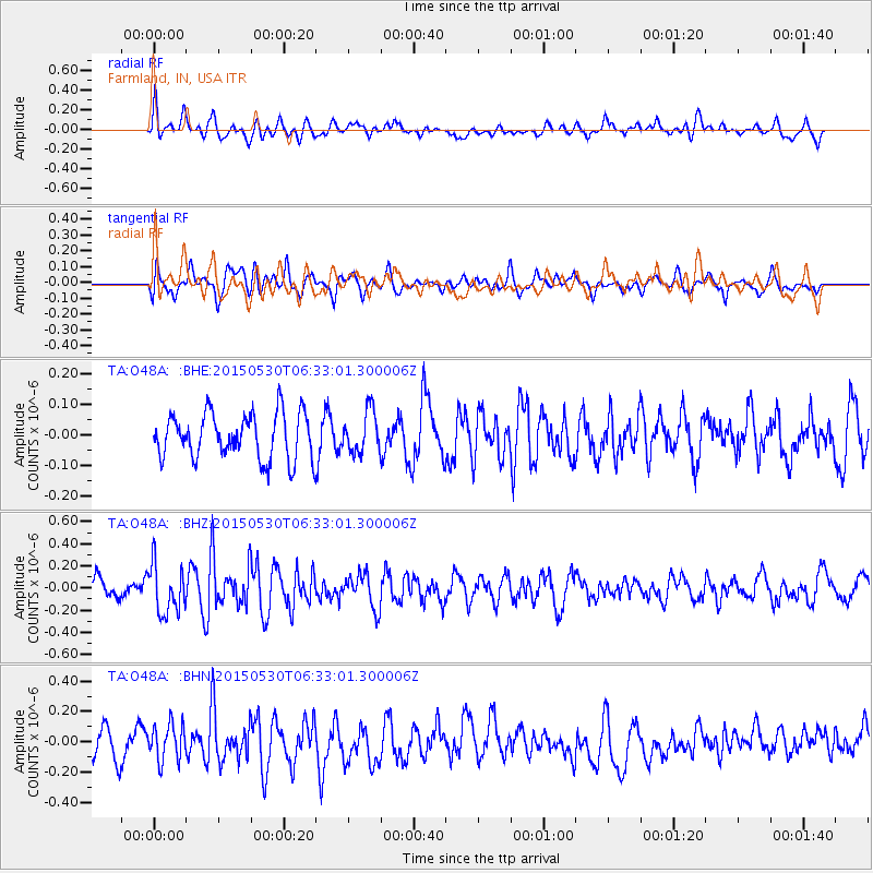
O48A Farmland, IN, USA - Earthquake Result Viewer
*The percent match for this event was below the threshold and hence no stack was calculated.
| Earthquake location: |
Near Coast Of Ecuador |
| Earthquake latitude/longitude: |
1.2/-79.6 |
| Earthquake time(UTC): |
2015/05/30 (150) 06:26:06 GMT |
| Earthquake Depth: |
26 km |
| Earthquake Magnitude: |
5.4 MW, 5.3 mb, 4.8 MS |
| Earthquake Catalog/Contributor: |
ISC/ISC |
|
| Network: |
TA USArray Transportable Network (new EarthScope stations) |
| Station: |
O48A Farmland, IN, USA |
| Lat/Lon: |
40.26 N/85.16 W |
| Elevation: |
300 m |
|
| Distance: |
39.2 deg |
| Az: |
353.231 deg |
| Baz: |
171.143 deg |
| Ray Param: |
$rayparam |
*The percent match for this event was below the threshold and hence was not used in the summary stack. |
|
| Radial Match: |
49.24759 % |
| Radial Bump: |
400 |
| Transverse Match: |
62.43531 % |
| Transverse Bump: |
400 |
| SOD ConfigId: |
7422571 |
| Insert Time: |
2019-04-19 03:05:11.999 +0000 |
| GWidth: |
2.5 |
| Max Bumps: |
400 |
| Tol: |
0.001 |
|
Signal To Noise
| Channel | StoN | STA | LTA |
| TA:O48A: :BHZ:20150530T06:33:01.300006Z | 2.4793334 | 2.1899241E-7 | 8.8327134E-8 |
| TA:O48A: :BHN:20150530T06:33:01.300006Z | 1.2462902 | 1.2204407E-7 | 9.7925884E-8 |
| TA:O48A: :BHE:20150530T06:33:01.300006Z | 0.9330457 | 6.8280336E-8 | 7.3180054E-8 |
| Arrivals |
| Ps | |
| PpPs | |
| PsPs/PpSs | |


