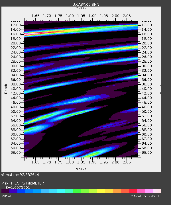
CASY Casey, Antarctica - Earthquake Result Viewer
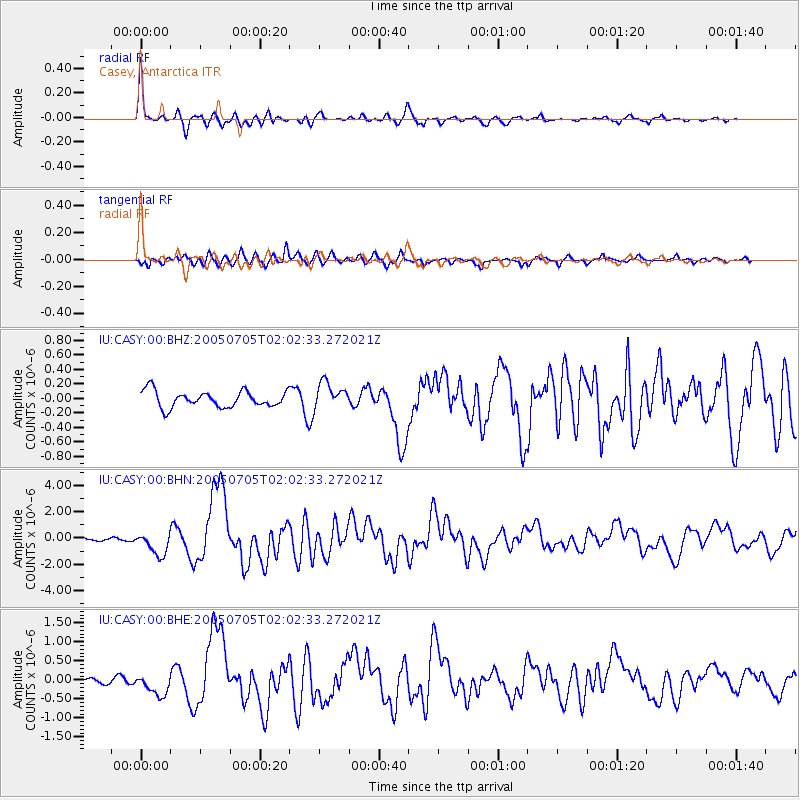
Earthquake location: Northern Sumatra, Indonesia
Earthquake latitude/longitude: 1.8/97.1
Earthquake time(UTC): 2005/07/05 (186) 01:52:02 GMT
Earthquake Depth: 21 km
Earthquake Magnitude: 6.2 MB, 6.8 MS, 6.7 MW, 6.6 MW
Earthquake Catalog/Contributor: WHDF/NEIC
Network: IU Global Seismograph Network (GSN - IRIS/USGS)
Station: CASY Casey, Antarctica
Lat/Lon: 66.28 S/110.54 E
Elevation: 159 m
Distance: 68.6 deg
Az: 174.199 deg
Baz: 345.539 deg
Ray Param: 0.0561566
Estimated Moho Depth: 15.75 km
Estimated Crust Vp/Vs: 1.61
Assumed Crust Vp: 6.356 km/s
Estimated Crust Vs: 3.954 km/s
Estimated Crust Poisson's Ratio: 0.18
Radial Match: 93.383644 %
Radial Bump: 360
Transverse Match: 77.515335 %
Transverse Bump: 400
SOD ConfigId: 3128
Insert Time: 2010-03-02 15:54:00.306 +0000
GWidth: 2.5
Max Bumps: 400
Tol: 0.001

Signal To Noise

ChannelStoNSTALTA
IU:CASY:00:BHN:20050705T02:02:33.272021Z6.2645988.5341935E-71.3622892E-7
IU:CASY:00:BHE:20050705T02:02:33.272021Z2.67945812.9070782E-71.08495E-7
IU:CASY:00:BHZ:20050705T02:02:33.272021Z1.59222581.7826113E-71.119572E-7
Arrivals
Ps1.6 SECOND
PpPs6.2 SECOND
PsPs/PpSs7.8 SECOND