CASY Casey, Antarctica - Earthquake Result Viewer
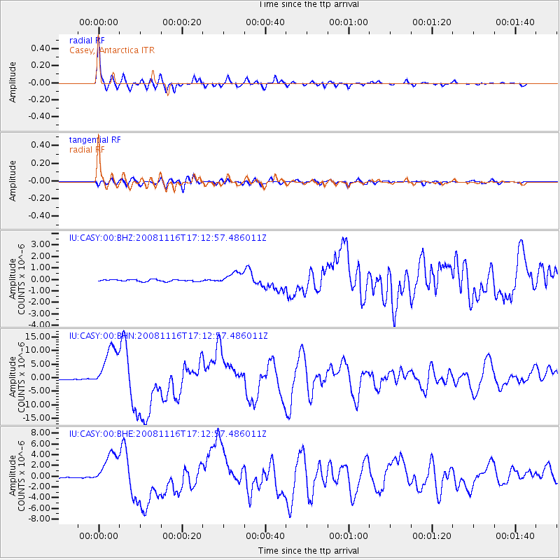
Earthquake location: Minahassa Peninsula, Sulawesi
Earthquake latitude/longitude: 1.3/122.1
Earthquake time(UTC): 2008/11/16 (321) 17:02:32 GMT
Earthquake Depth: 30 km
Earthquake Magnitude: 6.5 MB, 7.0 MS, 7.3 MW, 7.3 MW
Earthquake Catalog/Contributor: WHDF/NEIC
Network: IU Global Seismograph Network (GSN - IRIS/USGS)
Station: CASY Casey, Antarctica
Lat/Lon: 66.28 S/110.54 E
Elevation: 159 m
Distance: 67.9 deg
Az: 185.017 deg
Baz: 12.481 deg
Ray Param: 0.056606594
Estimated Moho Depth: 24.5 km
Estimated Crust Vp/Vs: 1.82
Assumed Crust Vp: 6.356 km/s
Estimated Crust Vs: 3.497 km/s
Estimated Crust Poisson's Ratio: 0.28
Radial Match: 97.00256 %
Radial Bump: 315
Transverse Match: 83.53876 %
Transverse Bump: 400
SOD ConfigId: 2658
Insert Time: 2010-03-02 15:54:38.677 +0000
GWidth: 2.5
Max Bumps: 400
Tol: 0.001

Signal To Noise

ChannelStoNSTALTA
IU:CASY:00:BHN:20081116T17:12:57.486011Z47.6151128.440881E-61.7727315E-7
IU:CASY:00:BHE:20081116T17:12:57.486011Z33.2091373.288935E-69.9037045E-8
IU:CASY:00:BHZ:20081116T17:12:57.486011Z6.94715365.356105E-77.709784E-8
Arrivals
Ps3.3 SECOND
PpPs10 SECOND
PsPs/PpSs14 SECOND