You are here: Home > Network List > IU - Global Seismograph Network (GSN - IRIS/USGS) Stations List
> Station RSSD Black Hills, South Dakota, USA > Earthquake Result Viewer
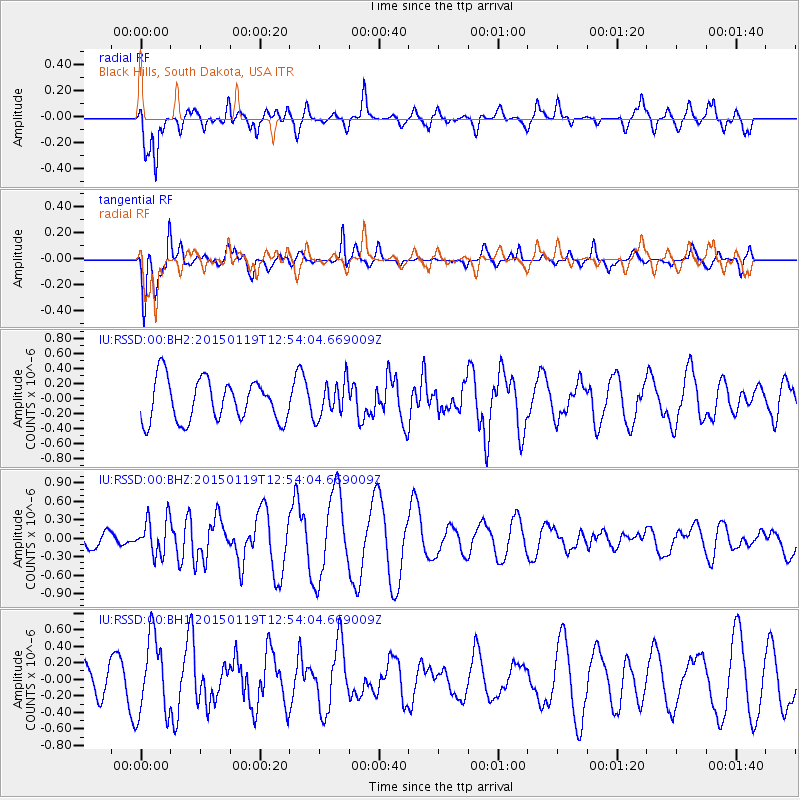
RSSD Black Hills, South Dakota, USA - Earthquake Result Viewer
*The percent match for this event was below the threshold and hence no stack was calculated.
| Earthquake location: |
Greenland Sea |
| Earthquake latitude/longitude: |
73.2/6.4 |
| Earthquake time(UTC): |
2015/01/19 (019) 12:45:13 GMT |
| Earthquake Depth: |
10 km |
| Earthquake Magnitude: |
5.5 MB |
| Earthquake Catalog/Contributor: |
NEIC PDE/NEIC COMCAT |
|
| Network: |
IU Global Seismograph Network (GSN - IRIS/USGS) |
| Station: |
RSSD Black Hills, South Dakota, USA |
| Lat/Lon: |
44.12 N/104.04 W |
| Elevation: |
2090 m |
|
| Distance: |
53.8 deg |
| Az: |
303.26 deg |
| Baz: |
19.699 deg |
| Ray Param: |
$rayparam |
*The percent match for this event was below the threshold and hence was not used in the summary stack. |
|
| Radial Match: |
61.30755 % |
| Radial Bump: |
400 |
| Transverse Match: |
58.341938 % |
| Transverse Bump: |
399 |
| SOD ConfigId: |
837871 |
| Insert Time: |
2015-02-02 13:05:03.392 +0000 |
| GWidth: |
2.5 |
| Max Bumps: |
400 |
| Tol: |
0.001 |
|
Signal To Noise
| Channel | StoN | STA | LTA |
| IU:RSSD:00:BHZ:20150119T12:54:04.669009Z | 1.3944359 | 2.9906377E-7 | 2.1446937E-7 |
| IU:RSSD:00:BH1:20150119T12:54:04.669009Z | 3.8560445 | 4.6823982E-7 | 1.2143009E-7 |
| IU:RSSD:00:BH2:20150119T12:54:04.669009Z | 0.8531706 | 2.3682081E-7 | 2.7757733E-7 |
| Arrivals |
| Ps | |
| PpPs | |
| PsPs/PpSs | |


