You are here: Home > Network List > TA - USArray Transportable Network (new EarthScope stations) Stations List
> Station A21K Barrow, AK, USA > Earthquake Result Viewer
A21K Barrow, AK, USA - Earthquake Result Viewer

| Earthquake location: |
Bonin Islands, Japan Region |
| Earthquake latitude/longitude: |
27.8/140.5 |
| Earthquake time(UTC): |
2015/05/30 (150) 11:23:02 GMT |
| Earthquake Depth: |
678 km |
| Earthquake Magnitude: |
7.8 MWP, 8.5 MI |
| Earthquake Catalog/Contributor: |
NEIC PDE/NEIC COMCAT |
|
| Network: |
TA USArray Transportable Network (new EarthScope stations) |
| Station: |
A21K Barrow, AK, USA |
| Lat/Lon: |
71.32 N/156.62 W |
| Elevation: |
577 m |
|
| Distance: |
55.3 deg |
| Az: |
20.423 deg |
| Baz: |
253.572 deg |
| Ray Param: |
0.06183353 |
| Estimated Moho Depth: |
46.5 km |
| Estimated Crust Vp/Vs: |
1.68 |
| Assumed Crust Vp: |
6.048 km/s |
| Estimated Crust Vs: |
3.605 km/s |
| Estimated Crust Poisson's Ratio: |
0.22 |
|
| Radial Match: |
95.461334 % |
| Radial Bump: |
400 |
| Transverse Match: |
86.63182 % |
| Transverse Bump: |
400 |
| SOD ConfigId: |
7422571 |
| Insert Time: |
2019-04-19 03:16:20.242 +0000 |
| GWidth: |
2.5 |
| Max Bumps: |
400 |
| Tol: |
0.001 |
|
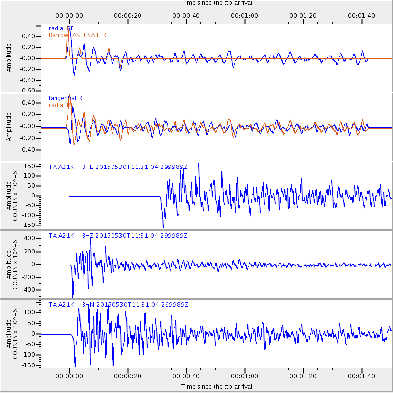
Signal To Noise
| Channel | StoN | STA | LTA |
| TA:A21K: :BHZ:20150530T11:31:04.299989Z | 161.50119 | 1.5635273E-4 | 9.681212E-7 |
| TA:A21K: :BHN:20150530T11:31:04.299989Z | 193.28944 | 5.861089E-5 | 3.0322863E-7 |
| TA:A21K: :BHE:20150530T11:31:04.299989Z | 102.09738 | 6.226916E-5 | 6.098997E-7 |
| Arrivals |
| Ps | 5.4 SECOND |
| PpPs | 20 SECOND |
| PsPs/PpSs | 25 SECOND |


