GNI Garni, Armenia - Earthquake Result Viewer
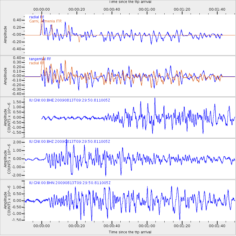
Earthquake location: Andaman Islands, India Region
Earthquake latitude/longitude: 14.1/92.8
Earthquake time(UTC): 2009/08/13 (225) 09:21:35 GMT
Earthquake Depth: 35 km
Earthquake Magnitude: 5.6 MB, 5.4 MS, 5.9 MW, 5.8 MW
Earthquake Catalog/Contributor: WHDF/NEIC
Network: IU Global Seismograph Network (GSN - IRIS/USGS)
Station: GNI Garni, Armenia
Lat/Lon: 40.15 N/44.74 E
Elevation: 1609 m
Distance: 49.3 deg
Az: 311.223 deg
Baz: 107.772 deg
Ray Param: 0.06871151
Estimated Moho Depth: 14.25 km
Estimated Crust Vp/Vs: 1.60
Assumed Crust Vp: 6.291 km/s
Estimated Crust Vs: 3.932 km/s
Estimated Crust Poisson's Ratio: 0.18
Radial Match: 84.31673 %
Radial Bump: 400
Transverse Match: 86.70973 %
Transverse Bump: 400
SOD ConfigId: 2622
Insert Time: 2010-03-03 13:46:25.041 +0000
GWidth: 2.5
Max Bumps: 400
Tol: 0.001

Signal To Noise

ChannelStoNSTALTA
IU:GNI:00:BHZ:20090813T09:29:50.811005Z4.51619772.9833302E-76.605845E-8
IU:GNI:00:BHN:20090813T09:29:50.811005Z1.2132521.0649204E-78.777405E-8
IU:GNI:00:BHE:20090813T09:29:50.811005Z0.745233656.5113305E-88.7373E-8
Arrivals
Ps1.4 SECOND
PpPs5.5 SECOND
PsPs/PpSs7.0 SECOND