You are here: Home > Network List > TA - USArray Transportable Network (new EarthScope stations) Stations List
> Station MDND Maddock, ND, USA > Earthquake Result Viewer
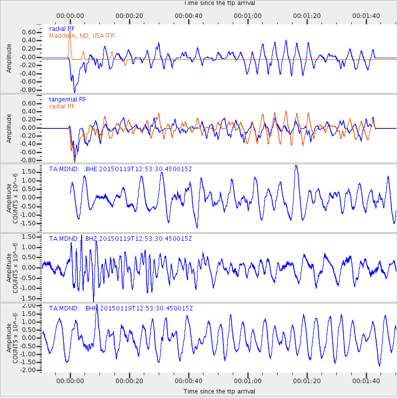
MDND Maddock, ND, USA - Earthquake Result Viewer
*The percent match for this event was below the threshold and hence no stack was calculated.
| Earthquake location: |
Greenland Sea |
| Earthquake latitude/longitude: |
73.2/6.4 |
| Earthquake time(UTC): |
2015/01/19 (019) 12:45:13 GMT |
| Earthquake Depth: |
10 km |
| Earthquake Magnitude: |
5.5 MB |
| Earthquake Catalog/Contributor: |
NEIC PDE/NEIC COMCAT |
|
| Network: |
TA USArray Transportable Network (new EarthScope stations) |
| Station: |
MDND Maddock, ND, USA |
| Lat/Lon: |
47.85 N/99.60 W |
| Elevation: |
479 m |
|
| Distance: |
49.2 deg |
| Az: |
301.244 deg |
| Baz: |
21.624 deg |
| Ray Param: |
$rayparam |
*The percent match for this event was below the threshold and hence was not used in the summary stack. |
|
| Radial Match: |
52.69657 % |
| Radial Bump: |
400 |
| Transverse Match: |
57.461643 % |
| Transverse Bump: |
363 |
| SOD ConfigId: |
837871 |
| Insert Time: |
2015-02-02 13:17:03.011 +0000 |
| GWidth: |
2.5 |
| Max Bumps: |
400 |
| Tol: |
0.001 |
|
Signal To Noise
| Channel | StoN | STA | LTA |
| TA:MDND: :BHZ:20150119T12:53:30.450015Z | 2.38523 | 7.872541E-7 | 3.3005375E-7 |
| TA:MDND: :BHN:20150119T12:53:30.450015Z | 1.1984801 | 7.2542144E-7 | 6.0528447E-7 |
| TA:MDND: :BHE:20150119T12:53:30.450015Z | 1.5551131 | 8.792251E-7 | 5.65377E-7 |
| Arrivals |
| Ps | |
| PpPs | |
| PsPs/PpSs | |


