
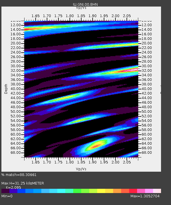
GNI Garni, Armenia - Earthquake Result Viewer
| ||||||||||||||||||
| ||||||||||||||||||
| ||||||||||||||||||
|
Signal To Noise
| Channel | StoN | STA | LTA |
| IU:GNI:00:BHN:20090316T14:27:38.077004Z | 4.4267964 | 5.586648E-7 | 1.2620069E-7 |
| IU:GNI:00:BHE:20090316T14:27:38.077004Z | 1.2735527 | 1.3898155E-7 | 1.0912901E-7 |
| IU:GNI:00:BHZ:20090316T14:27:38.077004Z | 1.2469491 | 1.6505976E-7 | 1.323709E-7 |
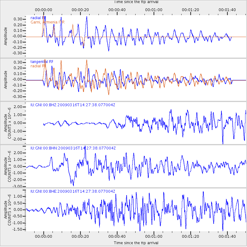
| Arrivals | |
| Ps | 5.6 SECOND |
| PpPs | 15 SECOND |
| PsPs/PpSs | 21 SECOND |

