You are here: Home > Network List > TA - USArray Transportable Network (new EarthScope stations) Stations List
> Station A21K Barrow, AK, USA > Earthquake Result Viewer
A21K Barrow, AK, USA - Earthquake Result Viewer
*The percent match for this event was below the threshold and hence no stack was calculated.
| Earthquake location: |
Greenland Sea |
| Earthquake latitude/longitude: |
73.2/6.4 |
| Earthquake time(UTC): |
2015/01/19 (019) 12:45:13 GMT |
| Earthquake Depth: |
10 km |
| Earthquake Magnitude: |
5.5 MB |
| Earthquake Catalog/Contributor: |
NEIC PDE/NEIC COMCAT |
|
| Network: |
TA USArray Transportable Network (new EarthScope stations) |
| Station: |
A21K Barrow, AK, USA |
| Lat/Lon: |
71.32 N/156.62 W |
| Elevation: |
577 m |
|
| Distance: |
35.3 deg |
| Az: |
350.643 deg |
| Baz: |
8.424 deg |
| Ray Param: |
$rayparam |
*The percent match for this event was below the threshold and hence was not used in the summary stack. |
|
| Radial Match: |
46.251305 % |
| Radial Bump: |
400 |
| Transverse Match: |
47.54237 % |
| Transverse Bump: |
347 |
| SOD ConfigId: |
837871 |
| Insert Time: |
2015-02-02 13:18:40.611 +0000 |
| GWidth: |
2.5 |
| Max Bumps: |
400 |
| Tol: |
0.001 |
|
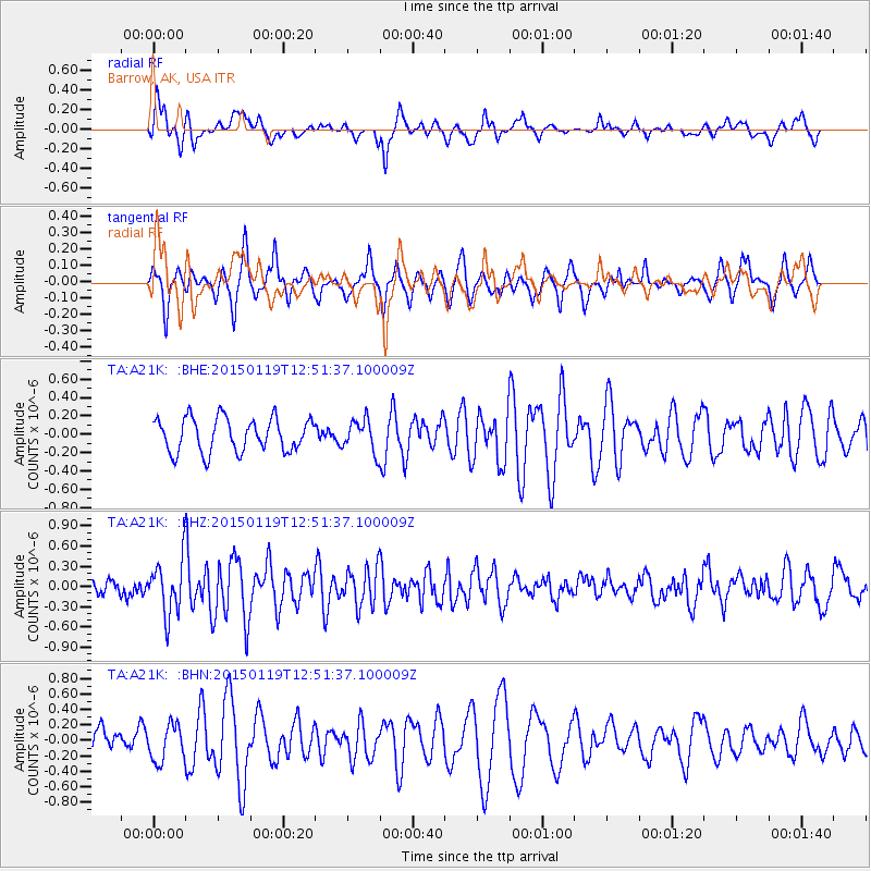
Signal To Noise
| Channel | StoN | STA | LTA |
| TA:A21K: :BHZ:20150119T12:51:37.100009Z | 3.376989 | 4.0394082E-7 | 1.1961568E-7 |
| TA:A21K: :BHN:20150119T12:51:37.100009Z | 1.6194403 | 2.3519759E-7 | 1.4523388E-7 |
| TA:A21K: :BHE:20150119T12:51:37.100009Z | 0.9602638 | 1.7482867E-7 | 1.8206318E-7 |
| Arrivals |
| Ps | |
| PpPs | |
| PsPs/PpSs | |


