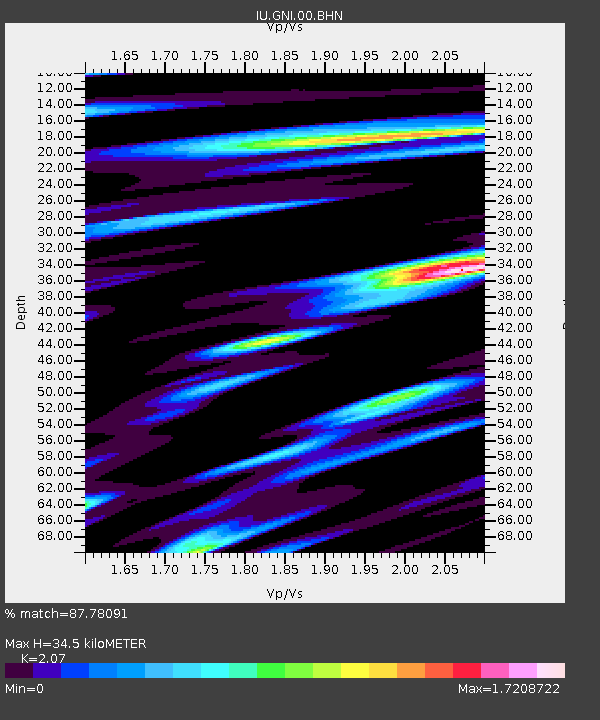
GNI Garni, Armenia - Earthquake Result Viewer
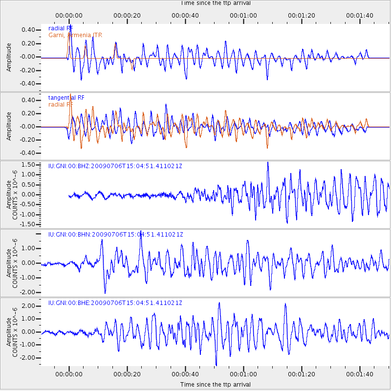
Earthquake location: Rat Islands, Aleutian Islands
Earthquake latitude/longitude: 50.4/177.0
Earthquake time(UTC): 2009/07/06 (187) 14:53:12 GMT
Earthquake Depth: 22 km
Earthquake Magnitude: 6.0 MB, 5.8 MS, 6.1 MW, 6.0 MW
Earthquake Catalog/Contributor: WHDF/NEIC
Network: IU Global Seismograph Network (GSN - IRIS/USGS)
Station: GNI Garni, Armenia
Lat/Lon: 40.15 N/44.74 E
Elevation: 1609 m
Distance: 80.6 deg
Az: 324.888 deg
Baz: 28.677 deg
Ray Param: 0.04817691
Estimated Moho Depth: 34.5 km
Estimated Crust Vp/Vs: 2.07
Assumed Crust Vp: 6.291 km/s
Estimated Crust Vs: 3.039 km/s
Estimated Crust Poisson's Ratio: 0.35
Radial Match: 87.78091 %
Radial Bump: 400
Transverse Match: 87.75726 %
Transverse Bump: 400
SOD ConfigId: 2648
Insert Time: 2010-03-03 13:46:54.653 +0000
GWidth: 2.5
Max Bumps: 400
Tol: 0.001

Signal To Noise

ChannelStoNSTALTA
IU:GNI:00:BHN:20090706T15:04:51.411021Z2.42943981.7336207E-77.135887E-8
IU:GNI:00:BHE:20090706T15:04:51.411021Z1.73484911.016553E-75.859605E-8
IU:GNI:00:BHZ:20090706T15:04:51.411021Z0.69806446.009701E-88.609092E-8
Arrivals
Ps6.0 SECOND
PpPs16 SECOND
PsPs/PpSs22 SECOND