GNI Garni, Armenia - Earthquake Result Viewer
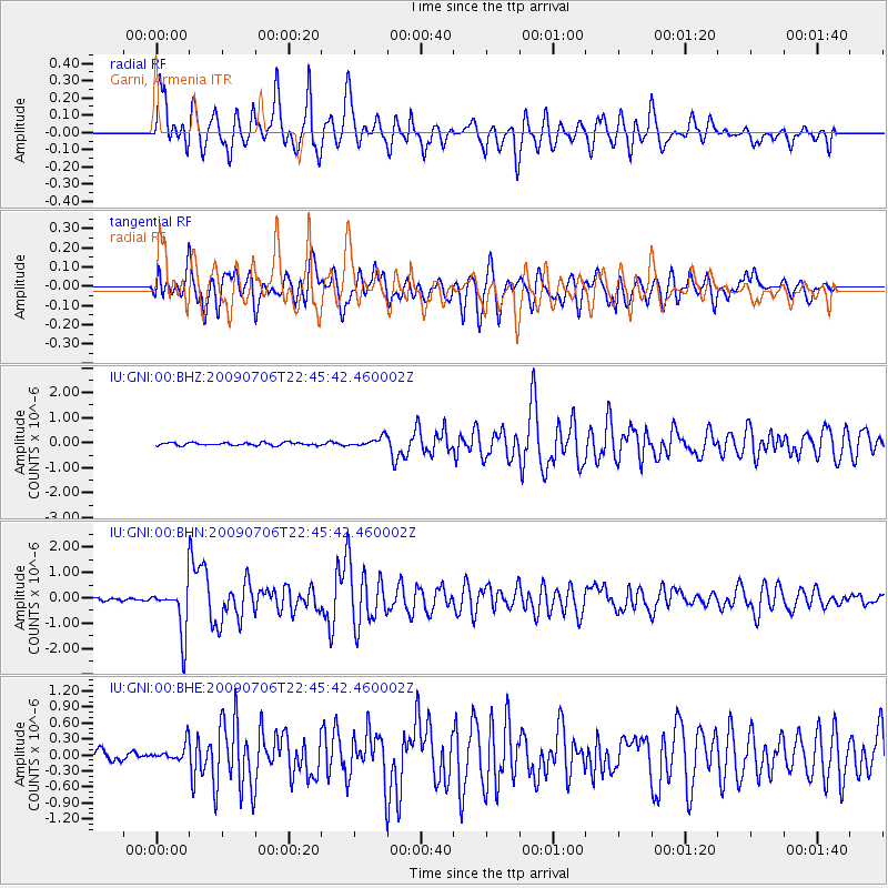
Earthquake location: Southeast Of Ryukyu Islands
Earthquake latitude/longitude: 24.9/128.0
Earthquake time(UTC): 2009/07/06 (187) 22:35:05 GMT
Earthquake Depth: 10 km
Earthquake Magnitude: 6.1 MB, 5.3 MS, 5.7 MW, 5.7 MW
Earthquake Catalog/Contributor: WHDF/NEIC
Network: IU Global Seismograph Network (GSN - IRIS/USGS)
Station: GNI Garni, Armenia
Lat/Lon: 40.15 N/44.74 E
Elevation: 1609 m
Distance: 69.5 deg
Az: 305.642 deg
Baz: 74.367 deg
Ray Param: 0.055599842
Estimated Moho Depth: 67.75 km
Estimated Crust Vp/Vs: 1.80
Assumed Crust Vp: 6.291 km/s
Estimated Crust Vs: 3.5 km/s
Estimated Crust Poisson's Ratio: 0.28
Radial Match: 85.792 %
Radial Bump: 400
Transverse Match: 78.27406 %
Transverse Bump: 400
SOD ConfigId: 2648
Insert Time: 2010-03-03 13:46:58.880 +0000
GWidth: 2.5
Max Bumps: 400
Tol: 0.001

Signal To Noise

ChannelStoNSTALTA
IU:GNI:00:BHN:20090706T22:45:42.460002Z15.4186049.788621E-76.348578E-8
IU:GNI:00:BHE:20090706T22:45:42.460002Z2.39671441.6363497E-76.82747E-8
IU:GNI:00:BHZ:20090706T22:45:42.460002Z3.417391.94567E-75.6934383E-8
Arrivals
Ps8.9 SECOND
PpPs29 SECOND
PsPs/PpSs38 SECOND