
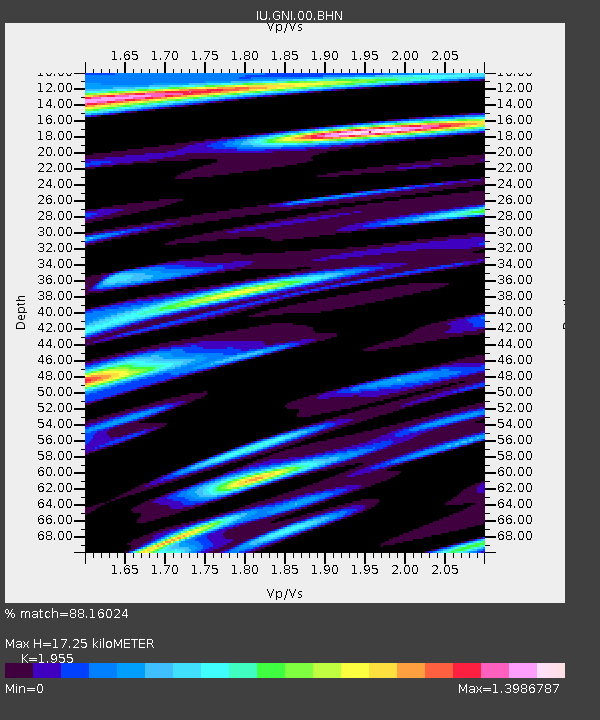
GNI Garni, Armenia - Earthquake Result Viewer
| ||||||||||||||||||
| ||||||||||||||||||
| ||||||||||||||||||
|
Signal To Noise
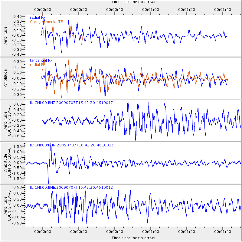
| Channel | StoN | STA | LTA |
| IU:GNI:00:BHN:20090707T16:42:20.461001Z | 12.985618 | 7.901952E-7 | 6.085157E-8 |
| IU:GNI:00:BHE:20090707T16:42:20.461001Z | 2.2325575 | 1.5308136E-7 | 6.856771E-8 |
| IU:GNI:00:BHZ:20090707T16:42:20.461001Z | 1.294926 | 9.8802694E-8 | 7.629988E-8 |
| Arrivals | |
| Ps | 2.7 SECOND |
| PpPs | 7.8 SECOND |
| PsPs/PpSs | 11 SECOND |

