GNI Garni, Armenia - Earthquake Result Viewer
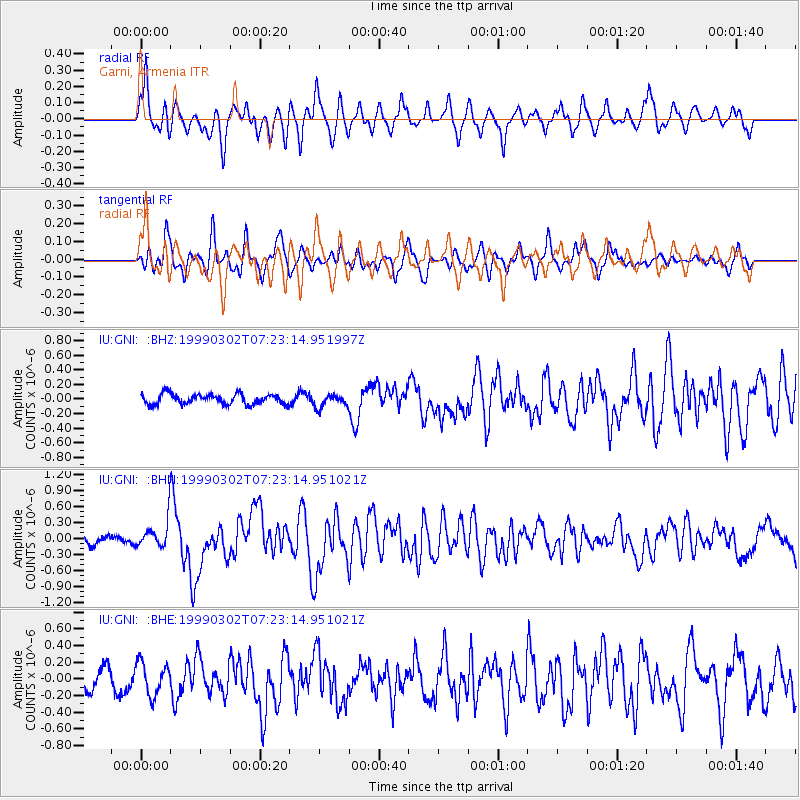
Earthquake location: Near East Coast Of Honshu, Japan
Earthquake latitude/longitude: 35.6/141.8
Earthquake time(UTC): 1999/03/02 (061) 07:12:20 GMT
Earthquake Depth: 33 km
Earthquake Magnitude: 5.6 MS, 5.4 MB, 6.1 MW, 6.0 MW
Earthquake Catalog/Contributor: WHDF/NEIC
Network: IU Global Seismograph Network (GSN - IRIS/USGS)
Station: GNI Garni, Armenia
Lat/Lon: 40.15 N/44.74 E
Elevation: 1609 m
Distance: 72.8 deg
Az: 307.208 deg
Baz: 57.871 deg
Ray Param: 0.053381704
Estimated Moho Depth: 10.0 km
Estimated Crust Vp/Vs: 1.60
Assumed Crust Vp: 6.291 km/s
Estimated Crust Vs: 3.932 km/s
Estimated Crust Poisson's Ratio: 0.18
Radial Match: 85.74435 %
Radial Bump: 400
Transverse Match: 67.45211 %
Transverse Bump: 400
SOD ConfigId: 4480
Insert Time: 2010-03-03 13:47:10.008 +0000
GWidth: 2.5
Max Bumps: 400
Tol: 0.001

Signal To Noise

ChannelStoNSTALTA
IU:GNI: :BHN:19990302T07:23:14.951021Z3.28763252.6100435E-77.938976E-8
IU:GNI: :BHE:19990302T07:23:14.951021Z2.34790091.9992103E-78.514884E-8
IU:GNI: :BHZ:19990302T07:23:14.951997Z1.27950258.905722E-86.9603004E-8
Arrivals
Ps1.0 SECOND
PpPs4.0 SECOND
PsPs/PpSs5.0 SECOND