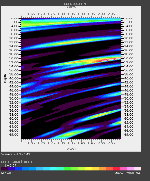
GNI Garni, Armenia - Earthquake Result Viewer
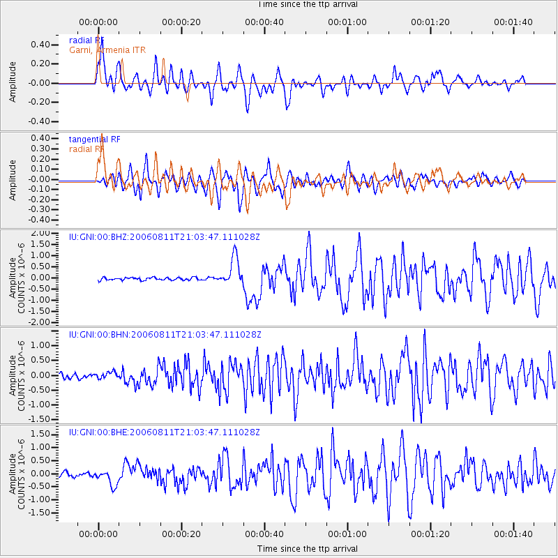
Earthquake location: Northern Sumatra, Indonesia
Earthquake latitude/longitude: 2.4/96.3
Earthquake time(UTC): 2006/08/11 (223) 20:54:14 GMT
Earthquake Depth: 22 km
Earthquake Magnitude: 5.8 MB, 6.2 MS, 6.2 MW, 6.1 MW
Earthquake Catalog/Contributor: WHDF/NEIC
Network: IU Global Seismograph Network (GSN - IRIS/USGS)
Station: GNI Garni, Armenia
Lat/Lon: 40.15 N/44.74 E
Elevation: 1609 m
Distance: 59.8 deg
Az: 315.988 deg
Baz: 115.086 deg
Ray Param: 0.061894983
Estimated Moho Depth: 30.0 km
Estimated Crust Vp/Vs: 2.07
Assumed Crust Vp: 6.291 km/s
Estimated Crust Vs: 3.039 km/s
Estimated Crust Poisson's Ratio: 0.35
Radial Match: 82.63421 %
Radial Bump: 400
Transverse Match: 83.541145 %
Transverse Bump: 400
SOD ConfigId: 2564
Insert Time: 2010-03-03 13:47:23.198 +0000
GWidth: 2.5
Max Bumps: 400
Tol: 0.001

Signal To Noise

ChannelStoNSTALTA
IU:GNI:00:BHN:20060811T21:03:47.111028Z1.35395961.157117E-78.546171E-8
IU:GNI:00:BHE:20060811T21:03:47.111028Z3.65811373.080935E-78.422195E-8
IU:GNI:00:BHZ:20060811T21:03:47.111028Z11.2754336.597665E-75.851363E-8
Arrivals
Ps5.3 SECOND
PpPs14 SECOND
PsPs/PpSs19 SECOND