
GNI Garni, Armenia - Earthquake Result Viewer
| ||||||||||||||||||
| ||||||||||||||||||
| ||||||||||||||||||
|
Signal To Noise
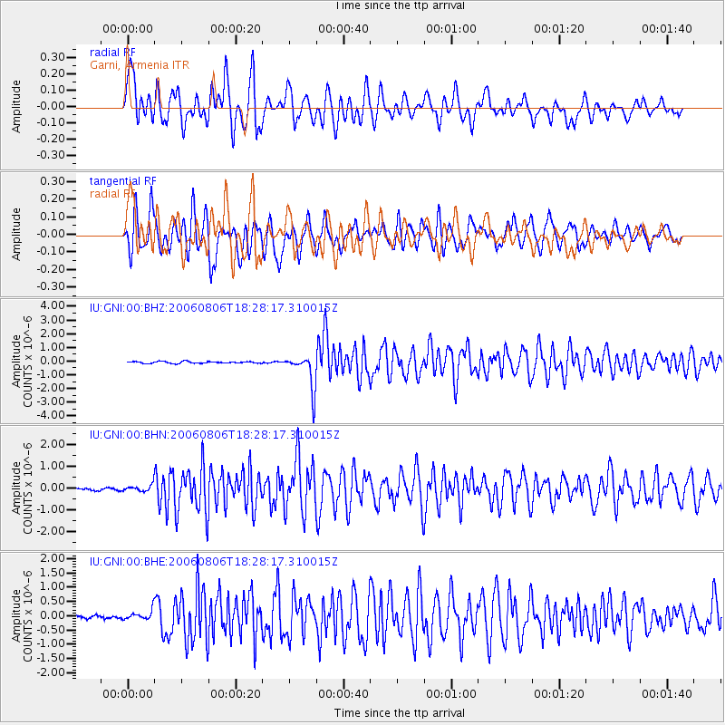
| Channel | StoN | STA | LTA |
| IU:GNI:00:BHN:20060806T18:28:17.310015Z | 2.2216825 | 1.5102303E-7 | 6.797688E-8 |
| IU:GNI:00:BHE:20060806T18:28:17.310015Z | 2.6131248 | 1.7157451E-7 | 6.565875E-8 |
| IU:GNI:00:BHZ:20060806T18:28:17.310015Z | 19.650476 | 1.2960049E-6 | 6.5952854E-8 |
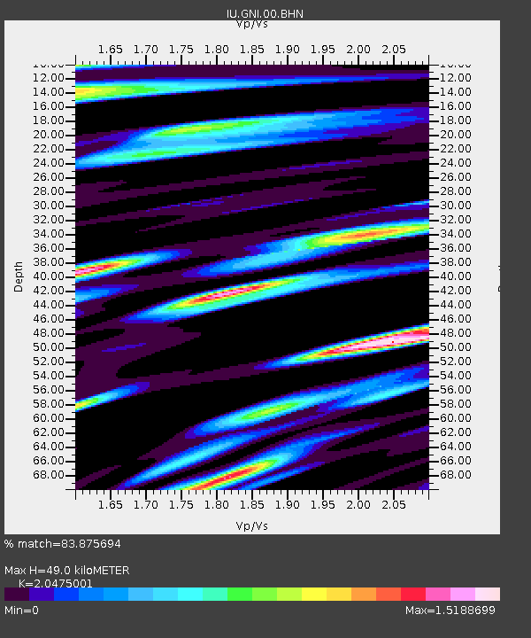
| Arrivals | |
| Ps | 8.4 SECOND |
| PpPs | 23 SECOND |
| PsPs/PpSs | 32 SECOND |

