
GNI Garni, Armenia - Earthquake Result Viewer
| ||||||||||||||||||
| ||||||||||||||||||
| ||||||||||||||||||
|
Signal To Noise
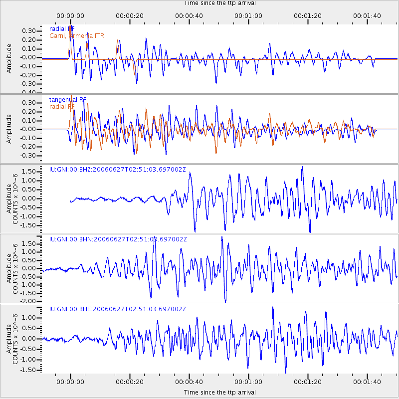
| Channel | StoN | STA | LTA |
| IU:GNI:00:BHN:20060627T02:51:03.697002Z | 2.49615 | 1.307454E-7 | 5.2378823E-8 |
| IU:GNI:00:BHE:20060627T02:51:03.697002Z | 1.3598962 | 1.0498452E-7 | 7.72004E-8 |
| IU:GNI:00:BHZ:20060627T02:51:03.697002Z | 4.6871924 | 3.3047627E-7 | 7.0506225E-8 |
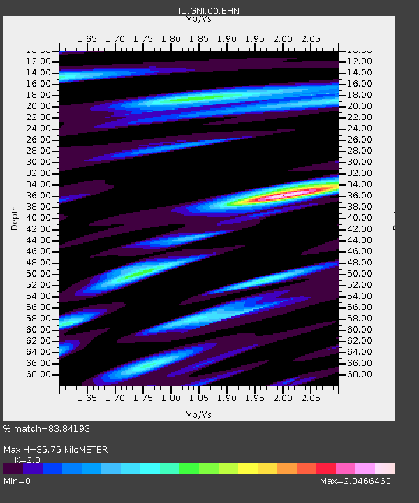
| Arrivals | |
| Ps | 5.8 SECOND |
| PpPs | 17 SECOND |
| PsPs/PpSs | 22 SECOND |

