You are here: Home > Network List > UU - University of Utah Regional Network Stations List
> Station KNB Kanab, UT, USA > Earthquake Result Viewer
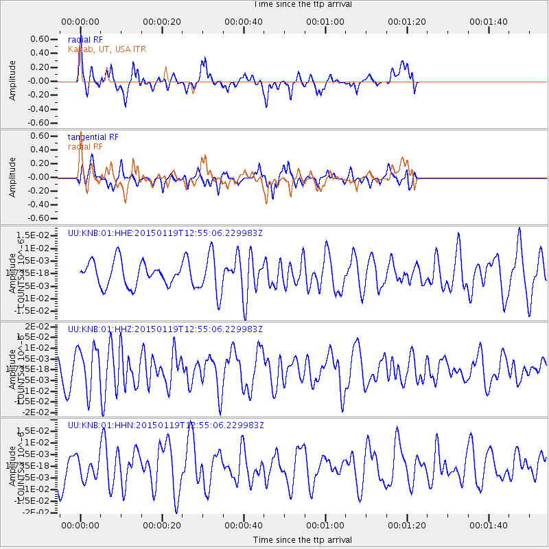
KNB Kanab, UT, USA - Earthquake Result Viewer
*The percent match for this event was below the threshold and hence no stack was calculated.
| Earthquake location: |
Greenland Sea |
| Earthquake latitude/longitude: |
73.2/6.4 |
| Earthquake time(UTC): |
2015/01/19 (019) 12:45:13 GMT |
| Earthquake Depth: |
10 km |
| Earthquake Magnitude: |
5.5 MB |
| Earthquake Catalog/Contributor: |
NEIC PDE/NEIC COMCAT |
|
| Network: |
UU University of Utah Regional Network |
| Station: |
KNB Kanab, UT, USA |
| Lat/Lon: |
37.02 N/112.82 W |
| Elevation: |
1715 m |
|
| Distance: |
62.6 deg |
| Az: |
308.148 deg |
| Baz: |
16.574 deg |
| Ray Param: |
$rayparam |
*The percent match for this event was below the threshold and hence was not used in the summary stack. |
|
| Radial Match: |
54.522816 % |
| Radial Bump: |
400 |
| Transverse Match: |
41.652336 % |
| Transverse Bump: |
325 |
| SOD ConfigId: |
837871 |
| Insert Time: |
2015-02-02 13:20:19.914 +0000 |
| GWidth: |
2.5 |
| Max Bumps: |
400 |
| Tol: |
0.001 |
|
Signal To Noise
| Channel | StoN | STA | LTA |
| UU:KNB:01:HHZ:20150119T12:55:06.229983Z | 2.8364823 | 1.011106E-8 | 3.564648E-9 |
| UU:KNB:01:HHN:20150119T12:55:06.229983Z | 0.42346385 | 4.7013407E-9 | 1.1102107E-8 |
| UU:KNB:01:HHE:20150119T12:55:06.229983Z | 1.8245544 | 8.372051E-9 | 4.588545E-9 |
| Arrivals |
| Ps | |
| PpPs | |
| PsPs/PpSs | |


