
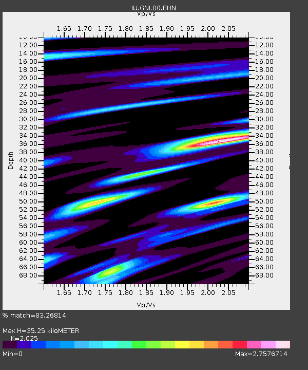
GNI Garni, Armenia - Earthquake Result Viewer
| ||||||||||||||||||
| ||||||||||||||||||
| ||||||||||||||||||
|
Signal To Noise
| Channel | StoN | STA | LTA |
| IU:GNI:00:BHN:20060614T04:30:17.197012Z | 0.9191348 | 7.243791E-8 | 7.881098E-8 |
| IU:GNI:00:BHE:20060614T04:30:17.197012Z | 1.5804075 | 1.1723174E-7 | 7.417817E-8 |
| IU:GNI:00:BHZ:20060614T04:30:17.197012Z | 1.5210674 | 1.5037088E-7 | 9.885879E-8 |
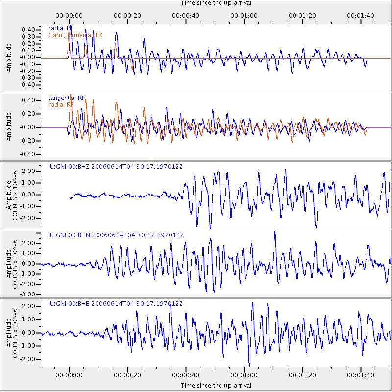
| Arrivals | |
| Ps | 5.9 SECOND |
| PpPs | 17 SECOND |
| PsPs/PpSs | 22 SECOND |

