You are here: Home > Network List > TA - USArray Transportable Network (new EarthScope stations) Stations List
> Station 435B Jarrell, TX, USA > Earthquake Result Viewer
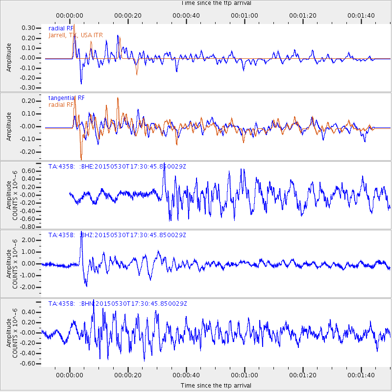
435B Jarrell, TX, USA - Earthquake Result Viewer
*The percent match for this event was below the threshold and hence no stack was calculated.
| Earthquake location: |
Tonga Islands |
| Earthquake latitude/longitude: |
-15.7/-173.3 |
| Earthquake time(UTC): |
2015/05/30 (150) 17:18:39 GMT |
| Earthquake Depth: |
51 km |
| Earthquake Magnitude: |
5.8 MB |
| Earthquake Catalog/Contributor: |
NEIC PDE/NEIC COMCAT |
|
| Network: |
TA USArray Transportable Network (new EarthScope stations) |
| Station: |
435B Jarrell, TX, USA |
| Lat/Lon: |
30.78 N/97.58 W |
| Elevation: |
248 m |
|
| Distance: |
86.2 deg |
| Az: |
56.716 deg |
| Baz: |
249.293 deg |
| Ray Param: |
$rayparam |
*The percent match for this event was below the threshold and hence was not used in the summary stack. |
|
| Radial Match: |
81.075806 % |
| Radial Bump: |
400 |
| Transverse Match: |
76.398575 % |
| Transverse Bump: |
400 |
| SOD ConfigId: |
7422571 |
| Insert Time: |
2019-04-19 03:30:32.295 +0000 |
| GWidth: |
2.5 |
| Max Bumps: |
400 |
| Tol: |
0.001 |
|
Signal To Noise
| Channel | StoN | STA | LTA |
| TA:435B: :BHZ:20150530T17:30:45.850029Z | 7.7355227 | 8.2532114E-7 | 1.0669236E-7 |
| TA:435B: :BHN:20150530T17:30:45.850029Z | 1.6357783 | 1.2272449E-7 | 7.5025135E-8 |
| TA:435B: :BHE:20150530T17:30:45.850029Z | 2.808832 | 2.5402312E-7 | 9.043728E-8 |
| Arrivals |
| Ps | |
| PpPs | |
| PsPs/PpSs | |


