
GNI Garni, Armenia - Earthquake Result Viewer
| ||||||||||||||||||
| ||||||||||||||||||
| ||||||||||||||||||
|
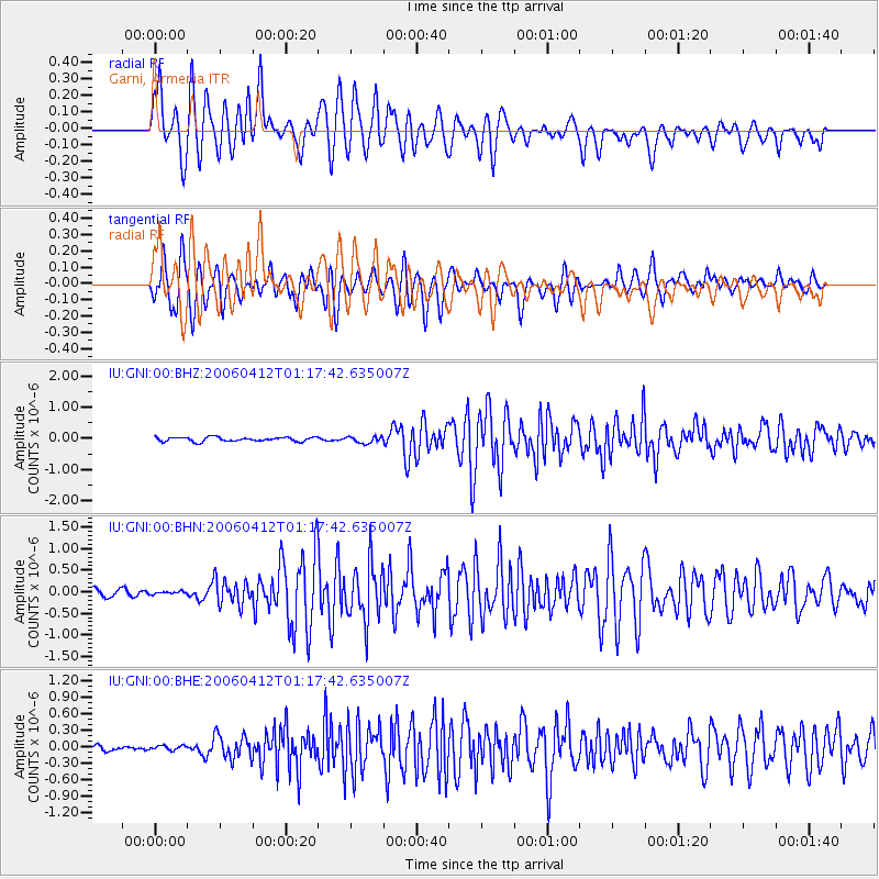
Signal To Noise
| Channel | StoN | STA | LTA |
| IU:GNI:00:BHN:20060412T01:17:42.635007Z | 0.4029806 | 3.4575176E-8 | 8.579862E-8 |
| IU:GNI:00:BHE:20060412T01:17:42.635007Z | 0.7883098 | 4.305424E-8 | 5.4615885E-8 |
| IU:GNI:00:BHZ:20060412T01:17:42.635007Z | 1.5686139 | 1.0590994E-7 | 6.751817E-8 |
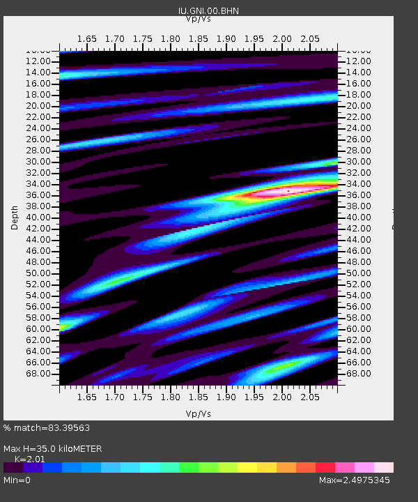
| Arrivals | |
| Ps | 5.8 SECOND |
| PpPs | 16 SECOND |
| PsPs/PpSs | 22 SECOND |

