
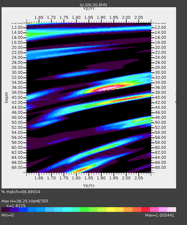
GNI Garni, Armenia - Earthquake Result Viewer
| ||||||||||||||||||
| ||||||||||||||||||
| ||||||||||||||||||
|
Signal To Noise
| Channel | StoN | STA | LTA |
| IU:GNI:00:BHN:20000716T03:32:08.774995Z | 0.93586344 | 6.584868E-8 | 7.036142E-8 |
| IU:GNI:00:BHE:20000716T03:32:08.774995Z | 1.5584822 | 9.575625E-8 | 6.1441995E-8 |
| IU:GNI:00:BHZ:20000716T03:32:08.774019Z | 1.5396447 | 1.1547013E-7 | 7.499791E-8 |
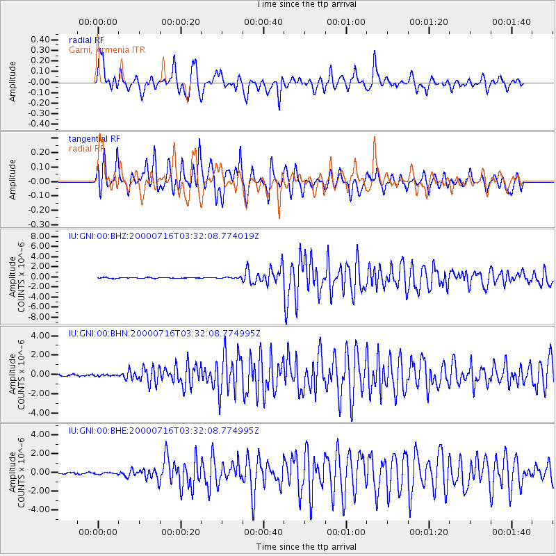
| Arrivals | |
| Ps | 5.5 SECOND |
| PpPs | 16 SECOND |
| PsPs/PpSs | 22 SECOND |

