
GNI Garni, Armenia - Earthquake Result Viewer
| ||||||||||||||||||
| ||||||||||||||||||
| ||||||||||||||||||
|
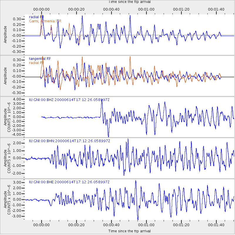
Signal To Noise
| Channel | StoN | STA | LTA |
| IU:GNI:00:BHN:20000614T17:12:26.058997Z | 0.6936157 | 6.579626E-8 | 9.485982E-8 |
| IU:GNI:00:BHE:20000614T17:12:26.058997Z | 2.1127505 | 1.7399567E-7 | 8.235505E-8 |
| IU:GNI:00:BHZ:20000614T17:12:26.058997Z | 15.856943 | 1.3141906E-6 | 8.287793E-8 |
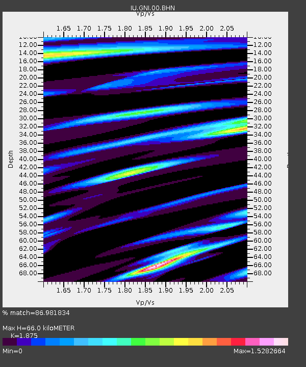
| Arrivals | |
| Ps | 9.4 SECOND |
| PpPs | 29 SECOND |
| PsPs/PpSs | 39 SECOND |

