You are here: Home > Network List > UW - Pacific Northwest Regional Seismic Network Stations List
> Station LEBA Lebam, WA, USA > Earthquake Result Viewer
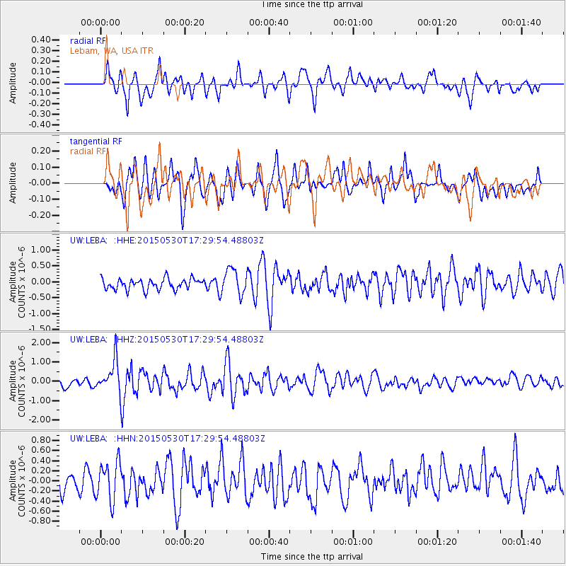
LEBA Lebam, WA, USA - Earthquake Result Viewer
*The percent match for this event was below the threshold and hence no stack was calculated.
| Earthquake location: |
Tonga Islands |
| Earthquake latitude/longitude: |
-15.7/-173.3 |
| Earthquake time(UTC): |
2015/05/30 (150) 17:18:39 GMT |
| Earthquake Depth: |
51 km |
| Earthquake Magnitude: |
5.8 MB |
| Earthquake Catalog/Contributor: |
NEIC PDE/NEIC COMCAT |
|
| Network: |
UW Pacific Northwest Regional Seismic Network |
| Station: |
LEBA Lebam, WA, USA |
| Lat/Lon: |
46.55 N/123.56 W |
| Elevation: |
73 m |
|
| Distance: |
76.4 deg |
| Az: |
32.816 deg |
| Baz: |
229.124 deg |
| Ray Param: |
$rayparam |
*The percent match for this event was below the threshold and hence was not used in the summary stack. |
|
| Radial Match: |
76.9379 % |
| Radial Bump: |
400 |
| Transverse Match: |
54.115795 % |
| Transverse Bump: |
400 |
| SOD ConfigId: |
7422571 |
| Insert Time: |
2019-04-19 03:32:30.936 +0000 |
| GWidth: |
2.5 |
| Max Bumps: |
400 |
| Tol: |
0.001 |
|
Signal To Noise
| Channel | StoN | STA | LTA |
| UW:LEBA: :HHZ:20150530T17:29:54.48803Z | 3.9789138 | 8.6653836E-7 | 2.1778264E-7 |
| UW:LEBA: :HHN:20150530T17:29:54.48803Z | 1.3895017 | 3.906904E-7 | 2.8117302E-7 |
| UW:LEBA: :HHE:20150530T17:29:54.48803Z | 2.3365033 | 4.0230677E-7 | 1.7218328E-7 |
| Arrivals |
| Ps | |
| PpPs | |
| PsPs/PpSs | |


