You are here: Home > Network List > UW - Pacific Northwest Regional Seismic Network Stations List
> Station PASS Maple Falls, WA, USA > Earthquake Result Viewer
PASS Maple Falls, WA, USA - Earthquake Result Viewer
*The percent match for this event was below the threshold and hence no stack was calculated.
| Earthquake location: |
Tonga Islands |
| Earthquake latitude/longitude: |
-15.7/-173.3 |
| Earthquake time(UTC): |
2015/05/30 (150) 17:18:39 GMT |
| Earthquake Depth: |
51 km |
| Earthquake Magnitude: |
5.8 MB |
| Earthquake Catalog/Contributor: |
NEIC PDE/NEIC COMCAT |
|
| Network: |
UW Pacific Northwest Regional Seismic Network |
| Station: |
PASS Maple Falls, WA, USA |
| Lat/Lon: |
49.00 N/122.09 W |
| Elevation: |
174 m |
|
| Distance: |
78.8 deg |
| Az: |
31.567 deg |
| Baz: |
229.948 deg |
| Ray Param: |
$rayparam |
*The percent match for this event was below the threshold and hence was not used in the summary stack. |
|
| Radial Match: |
73.08216 % |
| Radial Bump: |
400 |
| Transverse Match: |
57.771095 % |
| Transverse Bump: |
400 |
| SOD ConfigId: |
7422571 |
| Insert Time: |
2019-04-19 03:32:35.865 +0000 |
| GWidth: |
2.5 |
| Max Bumps: |
400 |
| Tol: |
0.001 |
|
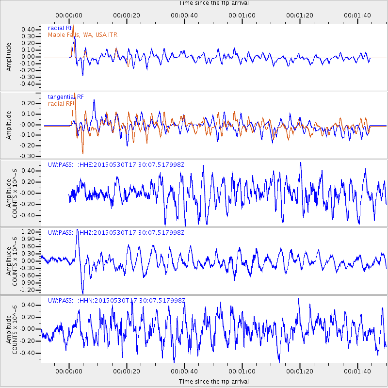
Signal To Noise
| Channel | StoN | STA | LTA |
| UW:PASS: :HHZ:20150530T17:30:07.517998Z | 4.9341936 | 6.436426E-7 | 1.3044534E-7 |
| UW:PASS: :HHN:20150530T17:30:07.517998Z | 1.5075593 | 1.5407906E-7 | 1.0220431E-7 |
| UW:PASS: :HHE:20150530T17:30:07.517998Z | 1.6961908 | 1.8235413E-7 | 1.0750803E-7 |
| Arrivals |
| Ps | |
| PpPs | |
| PsPs/PpSs | |


