You are here: Home > Network List > UW - Pacific Northwest Regional Seismic Network Stations List
> Station UMAT Pilot Rock, OR, USA > Earthquake Result Viewer
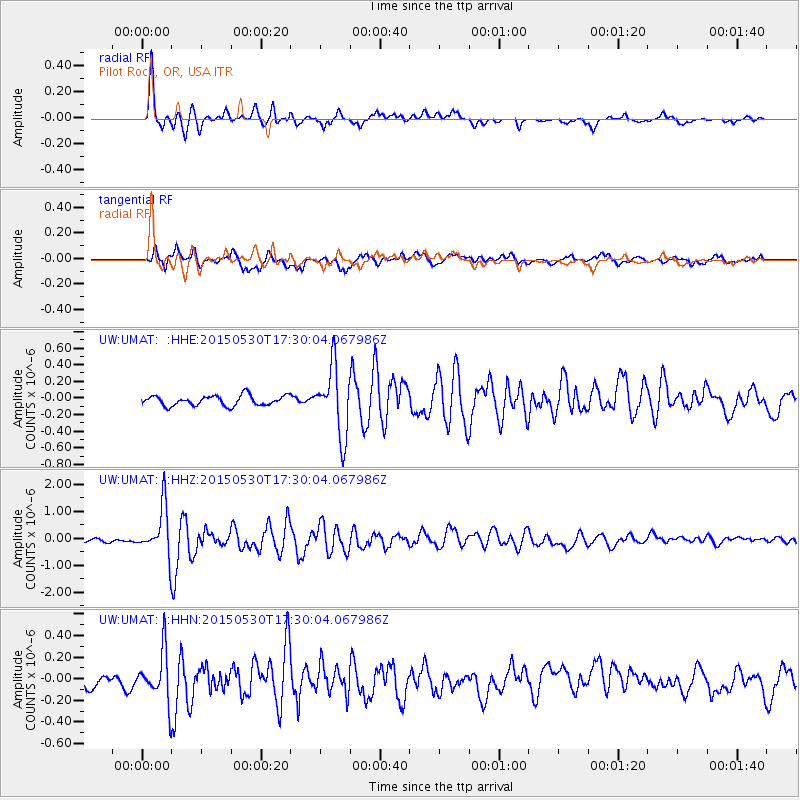
UMAT Pilot Rock, OR, USA - Earthquake Result Viewer
*The percent match for this event was below the threshold and hence no stack was calculated.
| Earthquake location: |
Tonga Islands |
| Earthquake latitude/longitude: |
-15.7/-173.3 |
| Earthquake time(UTC): |
2015/05/30 (150) 17:18:39 GMT |
| Earthquake Depth: |
51 km |
| Earthquake Magnitude: |
5.8 MB |
| Earthquake Catalog/Contributor: |
NEIC PDE/NEIC COMCAT |
|
| Network: |
UW Pacific Northwest Regional Seismic Network |
| Station: |
UMAT Pilot Rock, OR, USA |
| Lat/Lon: |
45.29 N/118.96 W |
| Elevation: |
1318 m |
|
| Distance: |
78.2 deg |
| Az: |
35.885 deg |
| Baz: |
233.096 deg |
| Ray Param: |
$rayparam |
*The percent match for this event was below the threshold and hence was not used in the summary stack. |
|
| Radial Match: |
91.4406 % |
| Radial Bump: |
355 |
| Transverse Match: |
75.65242 % |
| Transverse Bump: |
400 |
| SOD ConfigId: |
7422571 |
| Insert Time: |
2019-04-19 03:32:42.891 +0000 |
| GWidth: |
2.5 |
| Max Bumps: |
400 |
| Tol: |
0.001 |
|
Signal To Noise
| Channel | StoN | STA | LTA |
| UW:UMAT: :HHZ:20150530T17:30:04.067986Z | 11.654846 | 9.0166867E-7 | 7.736426E-8 |
| UW:UMAT: :HHN:20150530T17:30:04.067986Z | 3.588775 | 2.3231945E-7 | 6.4735026E-8 |
| UW:UMAT: :HHE:20150530T17:30:04.067986Z | 4.9788375 | 2.9262648E-7 | 5.877406E-8 |
| Arrivals |
| Ps | |
| PpPs | |
| PsPs/PpSs | |


