
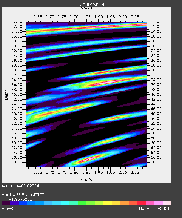
GNI Garni, Armenia - Earthquake Result Viewer
| ||||||||||||||||||
| ||||||||||||||||||
| ||||||||||||||||||
|
Signal To Noise
| Channel | StoN | STA | LTA |
| IU:GNI:00:BHN:20000604T16:38:56.911028Z | 0.8252697 | 1.3537972E-7 | 1.64043E-7 |
| IU:GNI:00:BHE:20000604T16:38:56.911028Z | 2.2049422 | 3.442561E-7 | 1.561293E-7 |
| IU:GNI:00:BHZ:20000604T16:38:56.909014Z | 2.2376084 | 4.7517727E-7 | 2.1235942E-7 |
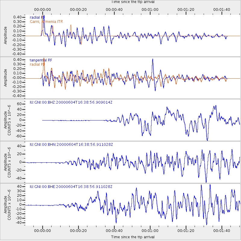
| Arrivals | |
| Ps | 9.4 SECOND |
| PpPs | 29 SECOND |
| PsPs/PpSs | 39 SECOND |

