GNI Garni, Armenia - Earthquake Result Viewer
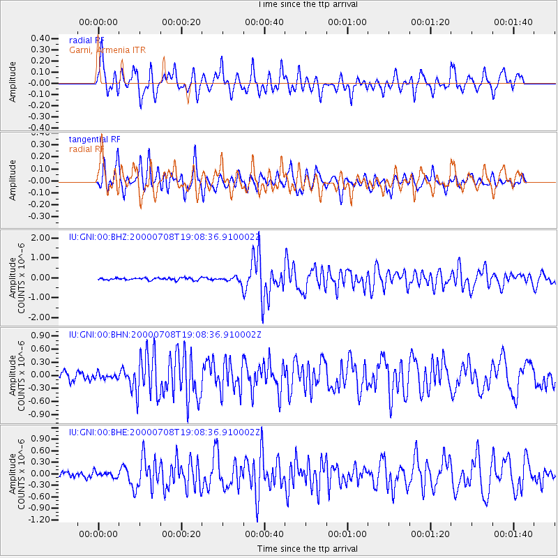
Earthquake location: Near S. Coast Of Honshu, Japan
Earthquake latitude/longitude: 34.1/139.1
Earthquake time(UTC): 2000/07/08 (190) 18:57:44 GMT
Earthquake Depth: 10 km
Earthquake Magnitude: 5.9 MB, 5.6 MS, 6.0 MW, 5.9 MW
Earthquake Catalog/Contributor: WHDF/NEIC
Network: IU Global Seismograph Network (GSN - IRIS/USGS)
Station: GNI Garni, Armenia
Lat/Lon: 40.15 N/44.74 E
Elevation: 1609 m
Distance: 72.0 deg
Az: 306.517 deg
Baz: 60.519 deg
Ray Param: 0.053964354
Estimated Moho Depth: 10.0 km
Estimated Crust Vp/Vs: 1.60
Assumed Crust Vp: 6.291 km/s
Estimated Crust Vs: 3.932 km/s
Estimated Crust Poisson's Ratio: 0.18
Radial Match: 83.54476 %
Radial Bump: 400
Transverse Match: 79.261765 %
Transverse Bump: 400
SOD ConfigId: 3744
Insert Time: 2010-03-03 13:49:23.275 +0000
GWidth: 2.5
Max Bumps: 400
Tol: 0.001

Signal To Noise

ChannelStoNSTALTA
IU:GNI:00:BHN:20000708T19:08:36.910002Z0.756749036.0349535E-87.974841E-8
IU:GNI:00:BHE:20000708T19:08:36.910002Z0.8045067.271905E-89.038969E-8
IU:GNI:00:BHZ:20000708T19:08:36.910002Z3.0390941.6528158E-75.4385147E-8
Arrivals
Ps1.0 SECOND
PpPs4.0 SECOND
PsPs/PpSs5.0 SECOND