GNI Garni, Armenia - Earthquake Result Viewer
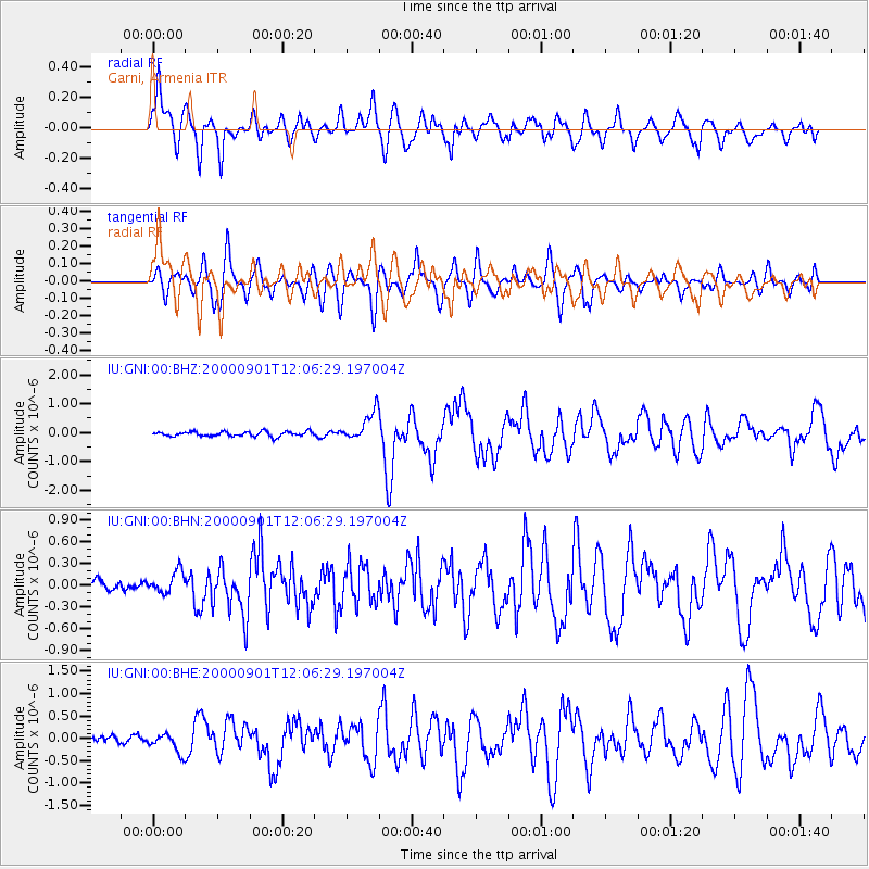
Earthquake location: Off W Coast Of Northern Sumatra
Earthquake latitude/longitude: 1.4/96.6
Earthquake time(UTC): 2000/09/01 (245) 11:56:51 GMT
Earthquake Depth: 33 km
Earthquake Magnitude: 5.6 MB, 6.0 MS, 6.2 MW, 6.0 MW
Earthquake Catalog/Contributor: WHDF/NEIC
Network: IU Global Seismograph Network (GSN - IRIS/USGS)
Station: GNI Garni, Armenia
Lat/Lon: 40.15 N/44.74 E
Elevation: 1609 m
Distance: 60.7 deg
Az: 316.275 deg
Baz: 115.649 deg
Ray Param: 0.0613013
Estimated Moho Depth: 11.25 km
Estimated Crust Vp/Vs: 2.08
Assumed Crust Vp: 6.291 km/s
Estimated Crust Vs: 3.024 km/s
Estimated Crust Poisson's Ratio: 0.35
Radial Match: 86.24931 %
Radial Bump: 400
Transverse Match: 82.600815 %
Transverse Bump: 400
SOD ConfigId: 3744
Insert Time: 2010-03-03 13:49:49.407 +0000
GWidth: 2.5
Max Bumps: 400
Tol: 0.001

Signal To Noise

ChannelStoNSTALTA
IU:GNI:00:BHN:20000901T12:06:29.197004Z2.24562841.4664906E-76.530424E-8
IU:GNI:00:BHE:20000901T12:06:29.197004Z3.47844122.0911784E-76.011826E-8
IU:GNI:00:BHZ:20000901T12:06:29.197004Z6.21296365.1625835E-78.309374E-8
Arrivals
Ps2.0 SECOND
PpPs5.3 SECOND
PsPs/PpSs7.3 SECOND