
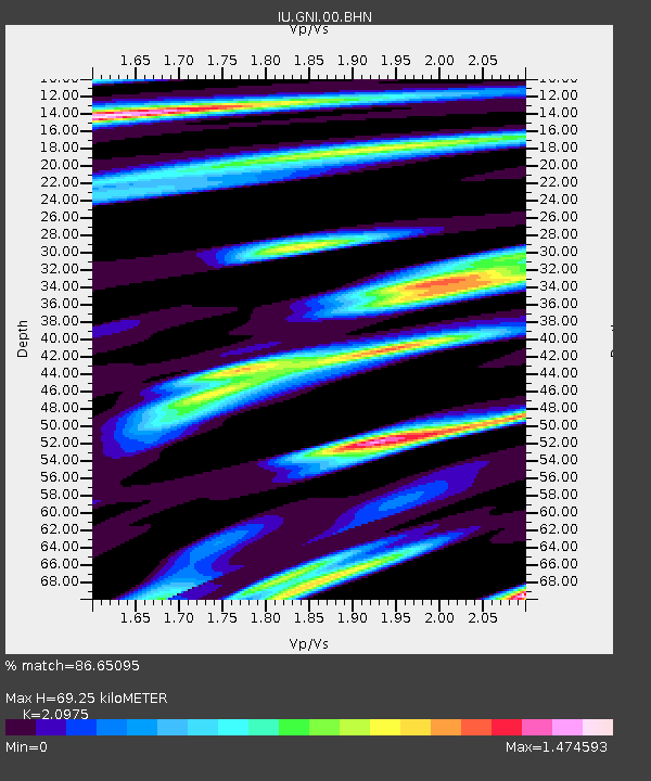
GNI Garni, Armenia - Earthquake Result Viewer
| ||||||||||||||||||
| ||||||||||||||||||
| ||||||||||||||||||
|
Signal To Noise
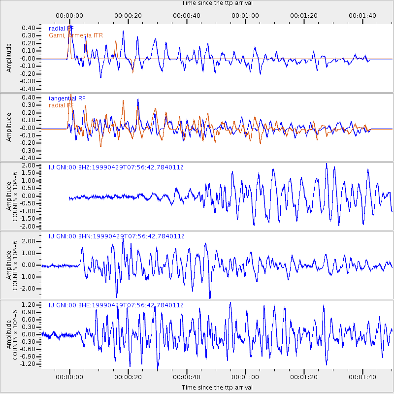
| Channel | StoN | STA | LTA |
| IU:GNI:00:BHN:19990429T07:56:42.784011Z | 8.835769 | 5.1063824E-7 | 5.779217E-8 |
| IU:GNI:00:BHE:19990429T07:56:42.784011Z | 1.4452085 | 1.2193887E-7 | 8.4374584E-8 |
| IU:GNI:00:BHZ:19990429T07:56:42.784011Z | 2.4931073 | 1.7701012E-7 | 7.09998E-8 |
| Arrivals | |
| Ps | 12 SECOND |
| PpPs | 33 SECOND |
| PsPs/PpSs | 46 SECOND |

