GNI Garni, Armenia - Earthquake Result Viewer
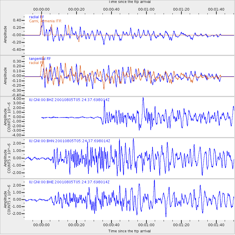
Earthquake location: Andaman Islands, India Region
Earthquake latitude/longitude: 12.2/93.4
Earthquake time(UTC): 2001/08/05 (217) 05:16:16 GMT
Earthquake Depth: 96 km
Earthquake Magnitude: 5.4 MB, 5.2 MS, 6.0 MW, 5.9 MW
Earthquake Catalog/Contributor: WHDF/NEIC
Network: IU Global Seismograph Network (GSN - IRIS/USGS)
Station: GNI Garni, Armenia
Lat/Lon: 40.15 N/44.74 E
Elevation: 1609 m
Distance: 50.9 deg
Az: 312.189 deg
Baz: 109.092 deg
Ray Param: 0.06745148
Estimated Moho Depth: 21.75 km
Estimated Crust Vp/Vs: 1.82
Assumed Crust Vp: 6.291 km/s
Estimated Crust Vs: 3.452 km/s
Estimated Crust Poisson's Ratio: 0.28
Radial Match: 86.256584 %
Radial Bump: 400
Transverse Match: 89.281364 %
Transverse Bump: 400
SOD ConfigId: 20082
Insert Time: 2010-03-03 13:50:19.441 +0000
GWidth: 2.5
Max Bumps: 400
Tol: 0.001

Signal To Noise

ChannelStoNSTALTA
IU:GNI:00:BHN:20010805T05:24:37.698014Z0.961294057.88796E-88.205564E-8
IU:GNI:00:BHE:20010805T05:24:37.698014Z0.981535147.595587E-87.738477E-8
IU:GNI:00:BHZ:20010805T05:24:37.698014Z4.9722882.7106057E-75.4514253E-8
Arrivals
Ps3.0 SECOND
PpPs9.3 SECOND
PsPs/PpSs12 SECOND