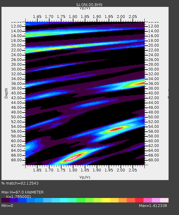
GNI Garni, Armenia - Earthquake Result Viewer
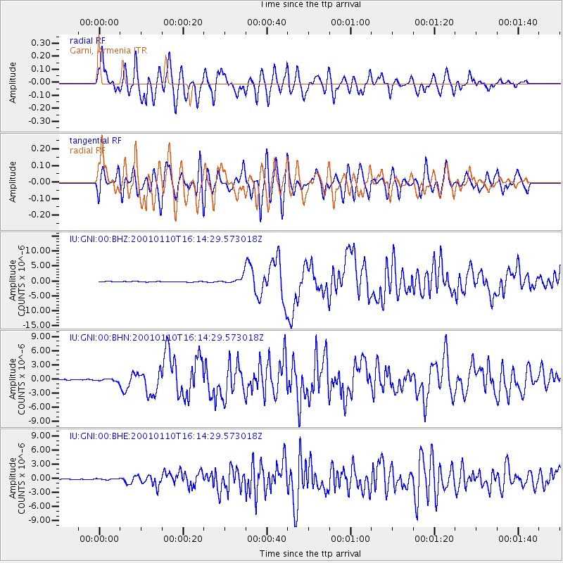
Earthquake location: Kodiak Island Region, Alaska
Earthquake latitude/longitude: 57.1/-153.2
Earthquake time(UTC): 2001/01/10 (010) 16:02:44 GMT
Earthquake Depth: 33 km
Earthquake Magnitude: 6.2 MB, 6.8 MS, 7.1 MW, 6.8 ML
Earthquake Catalog/Contributor: WHDF/NEIC
Network: IU Global Seismograph Network (GSN - IRIS/USGS)
Station: GNI Garni, Armenia
Lat/Lon: 40.15 N/44.74 E
Elevation: 1609 m
Distance: 82.0 deg
Az: 346.196 deg
Baz: 9.787 deg
Ray Param: 0.047173724
Estimated Moho Depth: 67.0 km
Estimated Crust Vp/Vs: 1.80
Assumed Crust Vp: 6.291 km/s
Estimated Crust Vs: 3.505 km/s
Estimated Crust Poisson's Ratio: 0.27
Radial Match: 82.12543 %
Radial Bump: 400
Transverse Match: 70.874344 %
Transverse Bump: 400
SOD ConfigId: 3744
Insert Time: 2010-03-03 13:50:34.954 +0000
GWidth: 2.5
Max Bumps: 400
Tol: 0.001

Signal To Noise

ChannelStoNSTALTA
IU:GNI:00:BHN:20010110T16:14:29.573018Z3.45336632.8459297E-78.24103E-8
IU:GNI:00:BHE:20010110T16:14:29.573018Z1.21136811.1223077E-79.264795E-8
IU:GNI:00:BHZ:20010110T16:14:29.573018Z13.7860681.3150323E-69.5388486E-8
Arrivals
Ps8.7 SECOND
PpPs29 SECOND
PsPs/PpSs38 SECOND