You are here: Home > Network List > TA - USArray Transportable Network (new EarthScope stations) Stations List
> Station R11A Troy Canyon, Currant, NV, USA > Earthquake Result Viewer
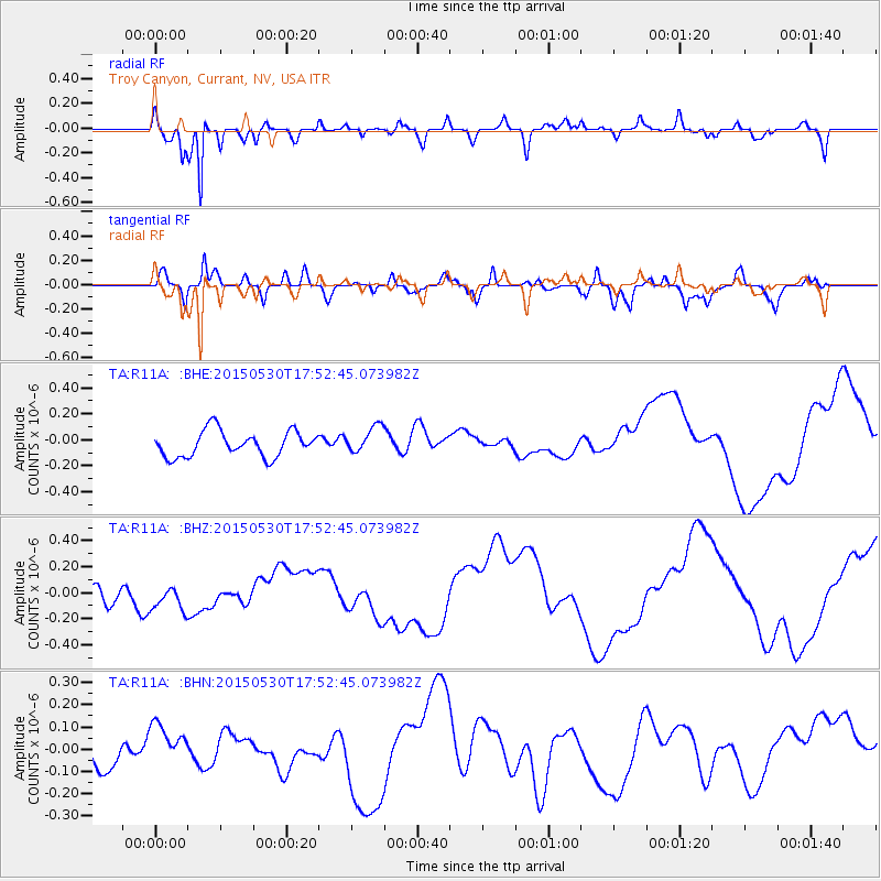
R11A Troy Canyon, Currant, NV, USA - Earthquake Result Viewer
*The percent match for this event was below the threshold and hence no stack was calculated.
| Earthquake location: |
Solomon Islands |
| Earthquake latitude/longitude: |
-7.5/156.2 |
| Earthquake time(UTC): |
2015/05/30 (150) 17:40:06 GMT |
| Earthquake Depth: |
44 km |
| Earthquake Magnitude: |
4.7 mb, 4.7 mb |
| Earthquake Catalog/Contributor: |
ISC/ISC |
|
| Network: |
TA USArray Transportable Network (new EarthScope stations) |
| Station: |
R11A Troy Canyon, Currant, NV, USA |
| Lat/Lon: |
38.35 N/115.59 W |
| Elevation: |
1756 m |
|
| Distance: |
93.2 deg |
| Az: |
51.913 deg |
| Baz: |
263.06 deg |
| Ray Param: |
$rayparam |
*The percent match for this event was below the threshold and hence was not used in the summary stack. |
|
| Radial Match: |
83.25247 % |
| Radial Bump: |
286 |
| Transverse Match: |
45.964745 % |
| Transverse Bump: |
400 |
| SOD ConfigId: |
7422571 |
| Insert Time: |
2019-04-19 03:38:31.625 +0000 |
| GWidth: |
2.5 |
| Max Bumps: |
400 |
| Tol: |
0.001 |
|
Signal To Noise
| Channel | StoN | STA | LTA |
| TA:R11A: :BHZ:20150530T17:52:45.073982Z | 1.2866199 | 1.2315229E-7 | 9.5717695E-8 |
| TA:R11A: :BHN:20150530T17:52:45.073982Z | 0.63584983 | 7.5896615E-8 | 1.1936248E-7 |
| TA:R11A: :BHE:20150530T17:52:45.073982Z | 1.0582914 | 1.04240144E-7 | 9.849852E-8 |
| Arrivals |
| Ps | |
| PpPs | |
| PsPs/PpSs | |


