You are here: Home > Network List > AV - Alaska Volcano Observatory Stations List
> Station MNAT Nateekin Bay, Makushin Volcano, Alaska > Earthquake Result Viewer
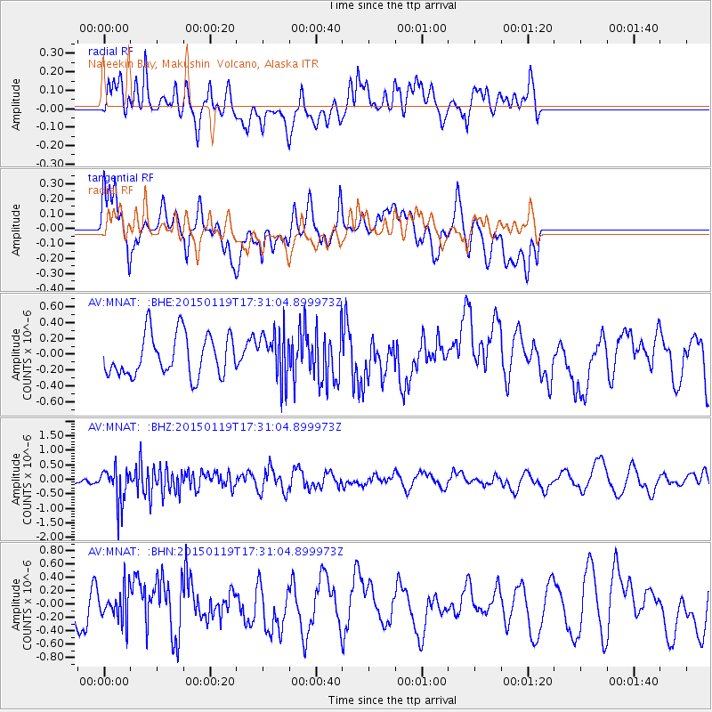
MNAT Nateekin Bay, Makushin Volcano, Alaska - Earthquake Result Viewer
*The percent match for this event was below the threshold and hence no stack was calculated.
| Earthquake location: |
Sulu Archipelago, Philippines |
| Earthquake latitude/longitude: |
4.6/119.8 |
| Earthquake time(UTC): |
2015/01/19 (019) 17:19:45 GMT |
| Earthquake Depth: |
11 km |
| Earthquake Magnitude: |
5.5 MWB |
| Earthquake Catalog/Contributor: |
NEIC PDE/NEIC COMCAT |
|
| Network: |
AV Alaska Volcano Observatory |
| Station: |
MNAT Nateekin Bay, Makushin Volcano, Alaska |
| Lat/Lon: |
53.88 N/166.69 W |
| Elevation: |
390 m |
|
| Distance: |
76.6 deg |
| Az: |
35.709 deg |
| Baz: |
259.335 deg |
| Ray Param: |
$rayparam |
*The percent match for this event was below the threshold and hence was not used in the summary stack. |
|
| Radial Match: |
51.397945 % |
| Radial Bump: |
400 |
| Transverse Match: |
58.582344 % |
| Transverse Bump: |
400 |
| SOD ConfigId: |
837871 |
| Insert Time: |
2015-02-02 17:30:26.509 +0000 |
| GWidth: |
2.5 |
| Max Bumps: |
400 |
| Tol: |
0.001 |
|
Signal To Noise
| Channel | StoN | STA | LTA |
| AV:MNAT: :BHZ:20150119T17:31:04.899973Z | 1.899475 | 6.257782E-7 | 3.29448E-7 |
| AV:MNAT: :BHN:20150119T17:31:04.899973Z | 0.8652616 | 2.3388898E-7 | 2.7031012E-7 |
| AV:MNAT: :BHE:20150119T17:31:04.899973Z | 1.1497246 | 3.0038612E-7 | 2.6126787E-7 |
| Arrivals |
| Ps | |
| PpPs | |
| PsPs/PpSs | |


