You are here: Home > Network List > G - GEOSCOPE Stations List
> Station PAF Port aux Francais, Kerguelen (South Indian Ocean) > Earthquake Result Viewer
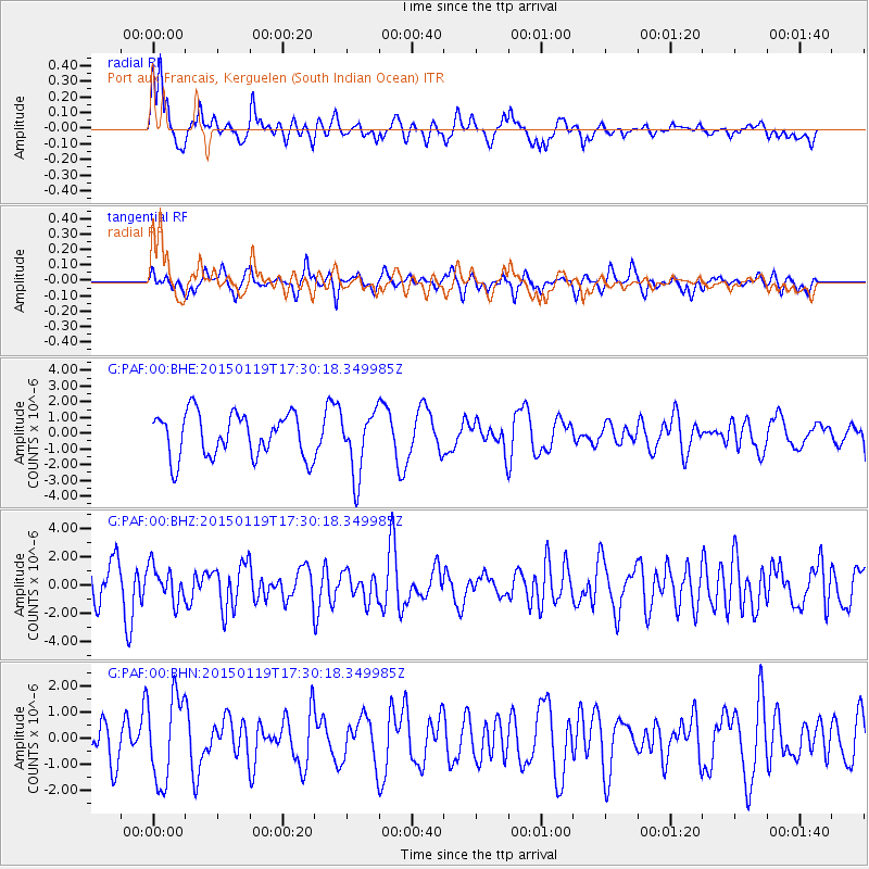
PAF Port aux Francais, Kerguelen (South Indian Ocean) - Earthquake Result Viewer
*The percent match for this event was below the threshold and hence no stack was calculated.
| Earthquake location: |
Sulu Archipelago, Philippines |
| Earthquake latitude/longitude: |
4.6/119.8 |
| Earthquake time(UTC): |
2015/01/19 (019) 17:19:45 GMT |
| Earthquake Depth: |
11 km |
| Earthquake Magnitude: |
5.5 MWB |
| Earthquake Catalog/Contributor: |
NEIC PDE/NEIC COMCAT |
|
| Network: |
G GEOSCOPE |
| Station: |
PAF Port aux Francais, Kerguelen (South Indian Ocean) |
| Lat/Lon: |
49.35 S/70.21 E |
| Elevation: |
17 m |
|
| Distance: |
68.8 deg |
| Az: |
212.269 deg |
| Baz: |
54.469 deg |
| Ray Param: |
$rayparam |
*The percent match for this event was below the threshold and hence was not used in the summary stack. |
|
| Radial Match: |
51.033855 % |
| Radial Bump: |
400 |
| Transverse Match: |
54.407856 % |
| Transverse Bump: |
400 |
| SOD ConfigId: |
837871 |
| Insert Time: |
2015-02-02 17:31:21.920 +0000 |
| GWidth: |
2.5 |
| Max Bumps: |
400 |
| Tol: |
0.001 |
|
Signal To Noise
| Channel | StoN | STA | LTA |
| G:PAF:00:BHZ:20150119T17:30:18.349985Z | 0.6945271 | 1.2124492E-6 | 1.7457191E-6 |
| G:PAF:00:BHN:20150119T17:30:18.349985Z | 1.5918096 | 1.6419243E-6 | 1.0314828E-6 |
| G:PAF:00:BHE:20150119T17:30:18.349985Z | 1.4255751 | 1.9969882E-6 | 1.4008298E-6 |
| Arrivals |
| Ps | |
| PpPs | |
| PsPs/PpSs | |


