You are here: Home > Network List > IU - Global Seismograph Network (GSN - IRIS/USGS) Stations List
> Station GNI Garni, Armenia > Earthquake Result Viewer
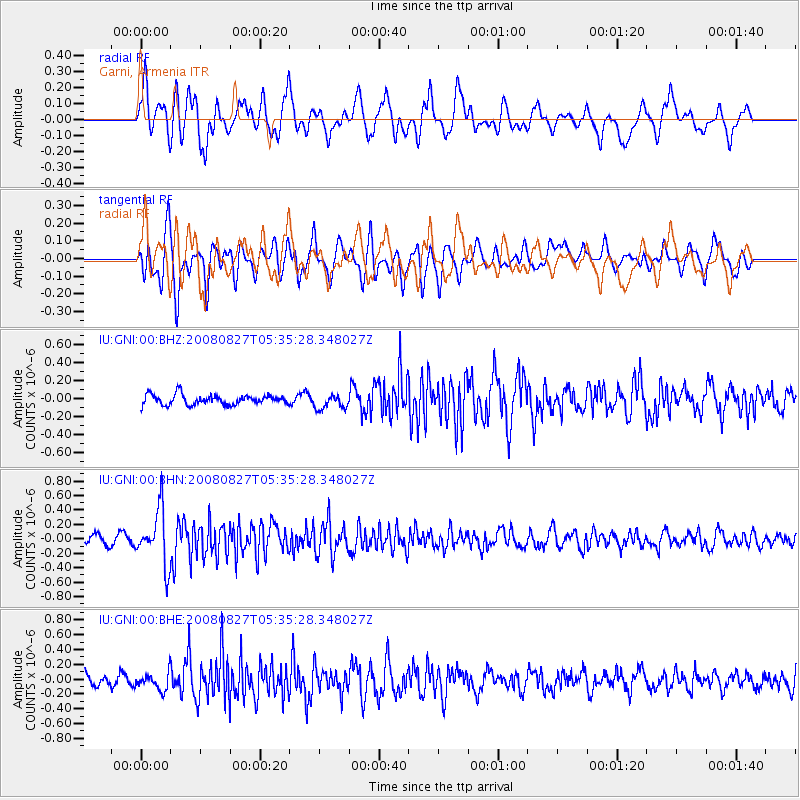
GNI Garni, Armenia - Earthquake Result Viewer
*The percent match for this event was below the threshold and hence no stack was calculated.
| Earthquake location: |
Kuril Islands |
| Earthquake latitude/longitude: |
46.7/152.5 |
| Earthquake time(UTC): |
2008/08/27 (240) 05:24:41 GMT |
| Earthquake Depth: |
65 km |
| Earthquake Magnitude: |
5.5 MB, 5.4 MW, 5.3 MW |
| Earthquake Catalog/Contributor: |
WHDF/NEIC |
|
| Network: |
IU Global Seismograph Network (GSN - IRIS/USGS) |
| Station: |
GNI Garni, Armenia |
| Lat/Lon: |
40.15 N/44.74 E |
| Elevation: |
1609 m |
|
| Distance: |
72.2 deg |
| Az: |
309.943 deg |
| Baz: |
43.479 deg |
| Ray Param: |
$rayparam |
*The percent match for this event was below the threshold and hence was not used in the summary stack. |
|
| Radial Match: |
73.14165 % |
| Radial Bump: |
400 |
| Transverse Match: |
63.899982 % |
| Transverse Bump: |
400 |
| SOD ConfigId: |
2504 |
| Insert Time: |
2010-03-03 13:53:12.381 +0000 |
| GWidth: |
2.5 |
| Max Bumps: |
400 |
| Tol: |
0.001 |
|
Signal To Noise
| Channel | StoN | STA | LTA |
| IU:GNI:00:BHN:20080827T05:35:28.348027Z | 5.6626635 | 3.8264022E-7 | 6.7572486E-8 |
| IU:GNI:00:BHE:20080827T05:35:28.348027Z | 1.295468 | 1.1279193E-7 | 8.706656E-8 |
| IU:GNI:00:BHZ:20080827T05:35:28.348027Z | 1.4677185 | 8.123717E-8 | 5.5349286E-8 |
| Arrivals |
| Ps | |
| PpPs | |
| PsPs/PpSs | |


